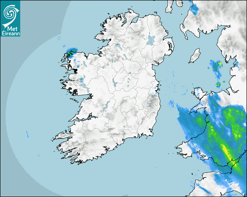

Latest Rainfall Radar showing live precipitation and the last 90 minutes precipitation over Ireland, updated every 5 minutes. Precipitation can be rain, hail or snow. Accumulations can refer to rainfall only.
Lightning strikes, when they occur, are displayed as a cross. Initially, they are red but change to orange and then yellow after a period, then disappear © Met Office ATDNet.
Ground Clutter may appear (South Co. Dublin), bright bands and spokes may also be present in images. They are artefacts (false echoes) of rainfall radar systems and should be ignored. Further information on Radar here
Met Éireann forecasters manually produce the weather icons for midday and midnight to reflect the predicted major weather type for these times.
The rainfall forecast is direct model output from Numerical Weather Prediction models but is a guideline only. Rain refers to precipitation, which can be rain, sleet or snow. It forecasts how much rain will fall (in mm) hourly during the previous hour (accumulations), then in 3 hourly and finally 6 hourly accumulations up to 7 days. This service is based on data and products of the European Centre for Medium-range Weather Forecasts (ECMWF)
The wind is direct model output from Numerical Weather Prediction models but is a guideline only. It forecasts the strength of the wind (in knots and km/h) at 10m for the top of each hour, in hourly, then 3 hourly and finally 6 hourly intervals up to 7 days. The wind arrow tip points in the direction the wind is blowing and the tail length indicates wind strength. However, in the text forecast below, it is described as where it is blowing from. This service is based on data and products of the European Centre for Medium-range Weather Forecasts (ECMWF).
The temperature is direct model output from Numerical Weather Prediction models but is a guideline only. It forecasts air temperature on land and over sea in °C for the top of each hour, 3 hourly and finally 6 hourly intervals up to 7 days. Minus zero (-0) indicates values between 0 to -0.5°C. This service is based on data and products of the European Centre for Medium-range Weather Forecasts (ECMWF).
The Mean Sea Level Pressure (MSLP) is direct model output from Numerical Weather Prediction models but is a guideline only. It forecasts the MSLP in hecto Pascals (hPa) for the top of that hour initially in 3 hourly intervals, then 6 hourly. This service is based on data and products of the European Centre for Medium-range Weather Forecasts (ECMWF).
National Forecast
01 May 2024 19:28
Tonight
Outbreaks of rain and drizzle will spread gradually westwards across the country overnight but parts of west Munster will hold dry until dawn on Thursday. Drier conditions will follow as the rain clears across Ulster and north Leinster later in the night. Lowest temperatures of 2 to 6 degrees, coldest in the southwest in generally light winds.
Tomorrow
Thursday will bring outbreaks of rain over the southern half of the country with some heavy and thundery falls possible. Highest temperatures in these areas will range a cool 9 to 12 degrees. After a damp start across the northern half of the country, cloud will break in places to allow for spells of warm sunshine to develop. Highest temperatures of 14 to 18 degrees in these parts. A moderate northerly breeze will develop during the course of the day.
Met News

01st May 2024
Government Launches Be Summer-Ready Campaign
The national ‘Be Summer-Ready’ campaign was la... more

19th April 2024
European State of the Climate 2023 & Climate of Ireland 2023
Issued Monday 22nd April 2024 Europe (From Coperni... more

19th April 2024
Daily UV Forecasts now available on Met.ie
The daily Solar UV Index level is now available wi... more

10th April 2024
We're Hiring Two Postdoctoral Researchers
Met Éireann, a line division of the Department of... more