Information on this page has been provided by the Environment Agency and was correct at the time of upload. The Flood Hub is not responsible for any information held on this page. For any enquiries, see the Contact section of the page.

The River Roch, Rochdale and Littleborough Flood Risk Management Scheme (FRMS) seeks to address the high level of flood risk to the towns of Rochdale and Littleborough in Greater Manchester.
The towns have a long history of flooding with significant events recorded in 1991, 1995, 2008 and 2015. On the 26th and 27th December 2015, 324 properties were flooded during Storm Eva. The flood exceeded the previous highest recorded levels along the River Roch, causing widespread damage and disruption in the area. More recently there was flooding in the towns in March 2019, July 2019, November 2019 and 9th February 2020 (Storm Ciara). Several flood warnings for the River Roch at Littleborough and Rochdale were issued during Storm Christoph during January 2021.
The steep catchment and multiple tributaries cause the River Roch to respond rapidly to rainfall with river levels rising quickly. The urbanised river valley has an industrial heritage with a legacy of modified channels, bridges, culverts and weirs which further exacerbate the flooding problem.

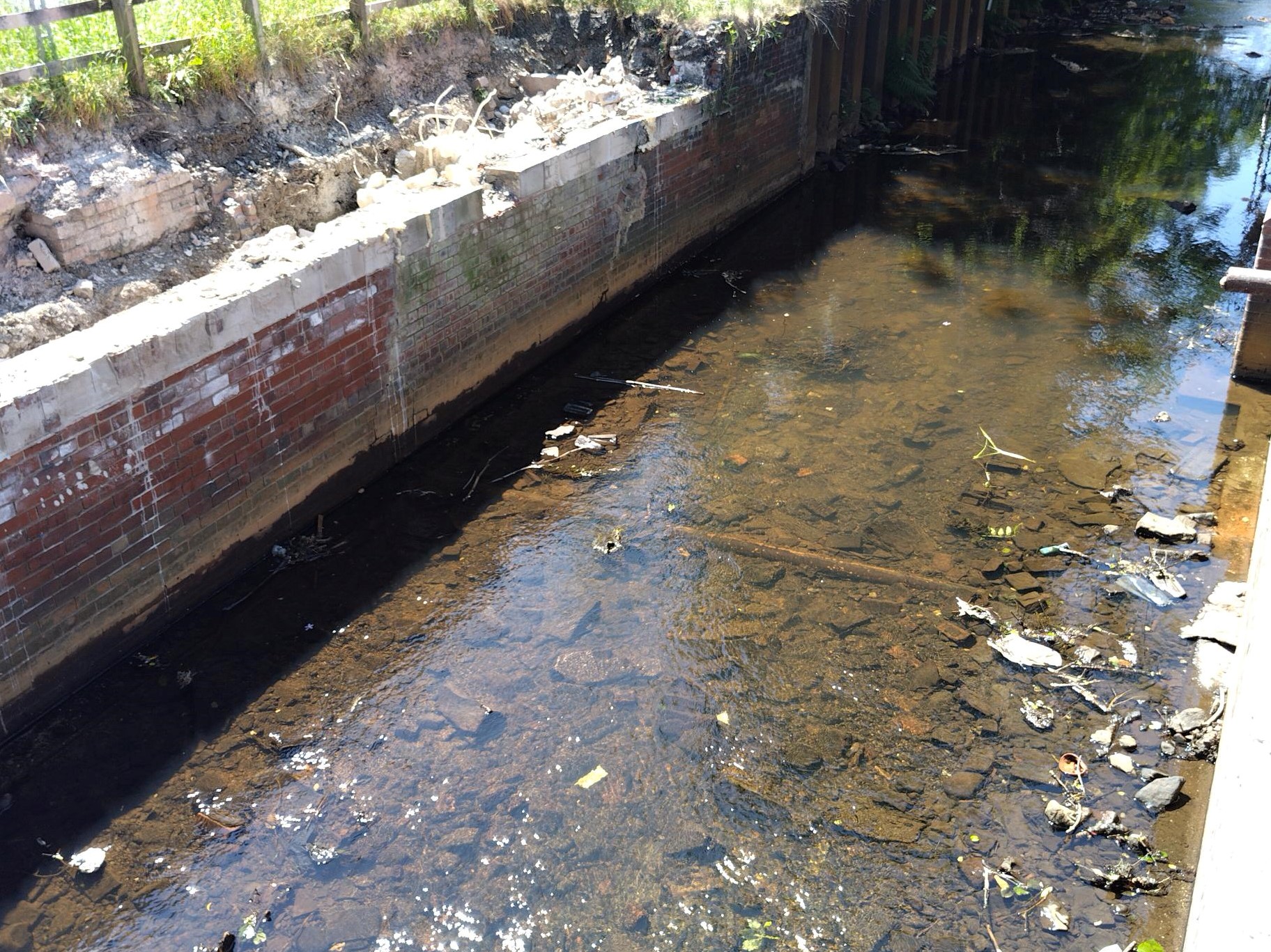
River Roch in Rochdale
| Milestone | Start |
| Phase 1A Planning Application Approved | May 2020 |
| Enabling Works Construction Start at Gale | March 2021 |
| Culvert Construction under the Railway at Gale | October 2021 |
| Planning Application Littleborough Phase 1B | July 2022 |
| Full Business Case Approval | September 2023 |
| Construction substantially complete Littleborough Phase 1A areas | February 2024 |
| Construction Start on remaining Littleborough Phase 1B areas | March 2024 |
| Detailed design Start on Rochdale Phase 2 | May 2024 |
| Construction start Rochdale Phase 2 | 2025/2026 |
Last updated: February 2024
Since 2012 the Environment Agency (EA) have worked with key partners, listened to and worked with the local community to generate a flood risk management scheme to reduce the risk of flooding in both Littleborough and Rochdale. Technical feasibility, economic viability, environmental sustainability and social acceptability were all considered when deciding on a preferred option.
The Phase 1 (Littleborough) and Phase 2 (Rochdale) schemes have the following associated benefits:
The scheme is led by the Environment Agency in partnership with Rochdale Borough Council. The scheme is funded by Government Flood Defence Grant in Aid (FDGiA) with contributions from, Network Rail, the North West RFCC, Transport for Greater Manchester, and the Departments for Education and Transport.
The planning application for Phase 1a including the enabling works was submitted to Rochdale Borough Council in January 2020 and was granted in May 2020 subject to planning conditions. The planning application can be viewed on the Rochdale Borough Council Website: https://publicaccess.rochdale.gov.uk/online-applications/applicationDetails.do?keyVal=Q4RTQPNBHTM00&activeTab=summary
The planning application for Phase 1b including the enabling works was submitted to Rochdale Borough Council in April 2022 and was granted in July 2022 subject to planning conditions. The planning application can be viewed on the Rochdale Borough Council Website: https://publicaccess.rochdale.gov.uk/online-applications/applicationDetails.do?activeTab=externalDocuments&keyVal=RA0S2JNB00700
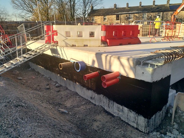
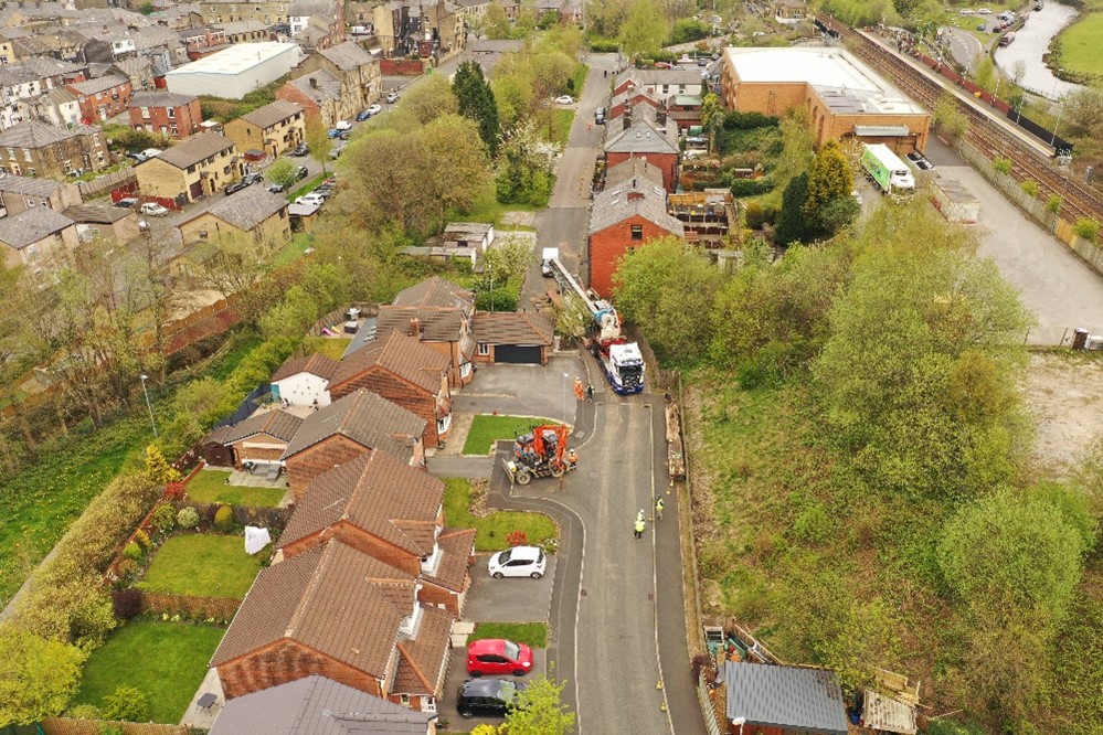
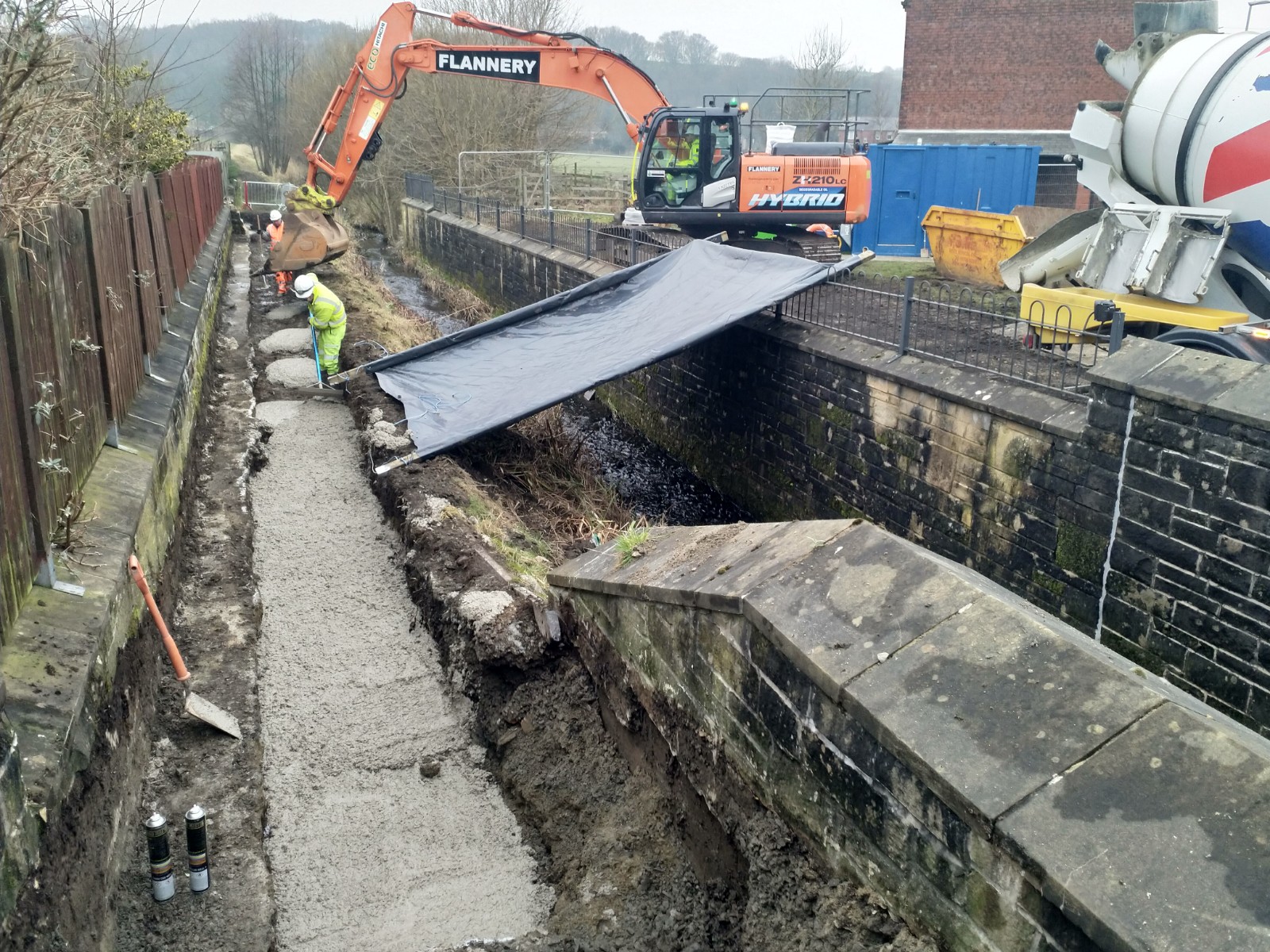
The construction of the accesses was crucial to the enabling works which saw Network Rail install a new culvert under the Calder Valley railway line. This culvert is a critical new asset for the future flood storage reservoir planned for the Gale site (Phase 1b) which will hold water back and slow the flow of the River Roch and Greenvale Brook into Littleborough town centre.
The access ramp into the Gale West site also enabled the Phase 1a & 1b site compound to be established and will allow the construction of the flood storage reservoir.
This phase consists of the following work packages related to various locations within Littleborough. With the exception of the Enabling Works package, these works began in Early 2022. The works undertaken were:
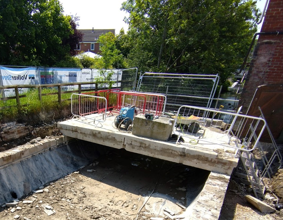
Riverstone Bridge – Demolition of existing road bridge and footbridge and replacement with a combined road and footbridge, river channel widening and associated landscaping works.
Charles Street – Removal of existing bridge over the River Roch due to causing a constriction to flood flows in the river. Erection of infill wall to close the gap with wall mounted railing and associated landscape works.
Peel Street – Modification of existing flood wall to raise the height and associated landscape works.
Town House Brook – Raising of existing flood defence wall, installation of coarse trash posts, raising and extension of pedestrian ramp and associated landscape works.
Carriage Drive – Bank repairs to re-instate channel width and removal of debris in the existing culverts.
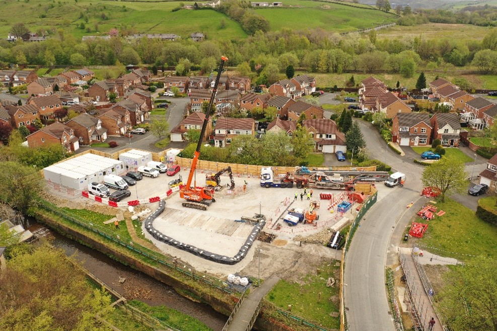
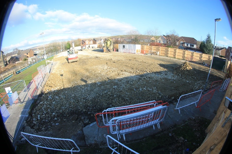
This phase comprises of the construction of a flood storage reservoir at the Gale site just off Todmorden Road. This phase comprises of the following work packages:
Grove Lodge – Construction of a flood defence wall along a rail embankment, habitat and footpath improvements.
Reddyshore Brow – Bank reinforcement, erosion control works to private gardens and waterproofing to private houses.
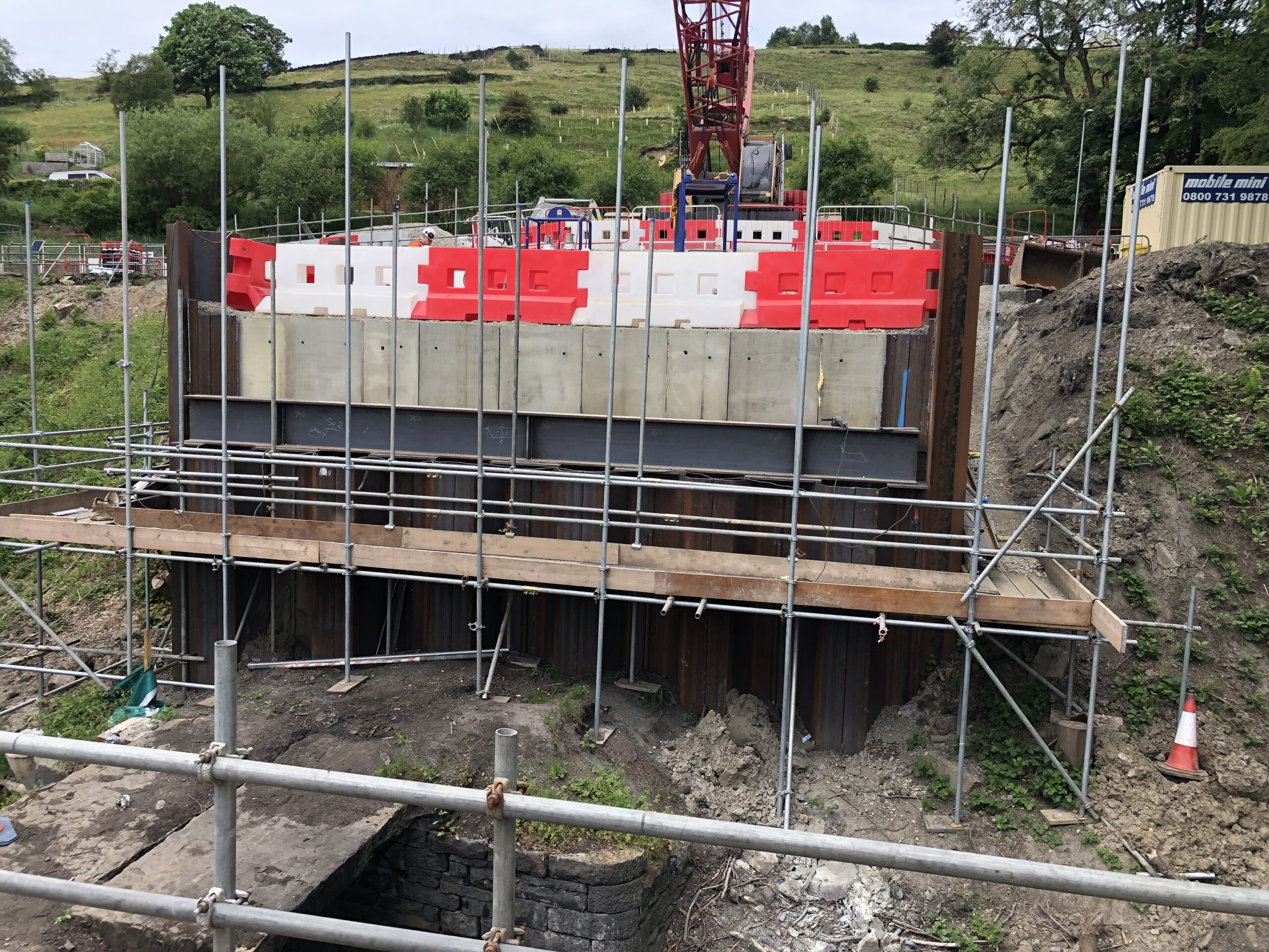
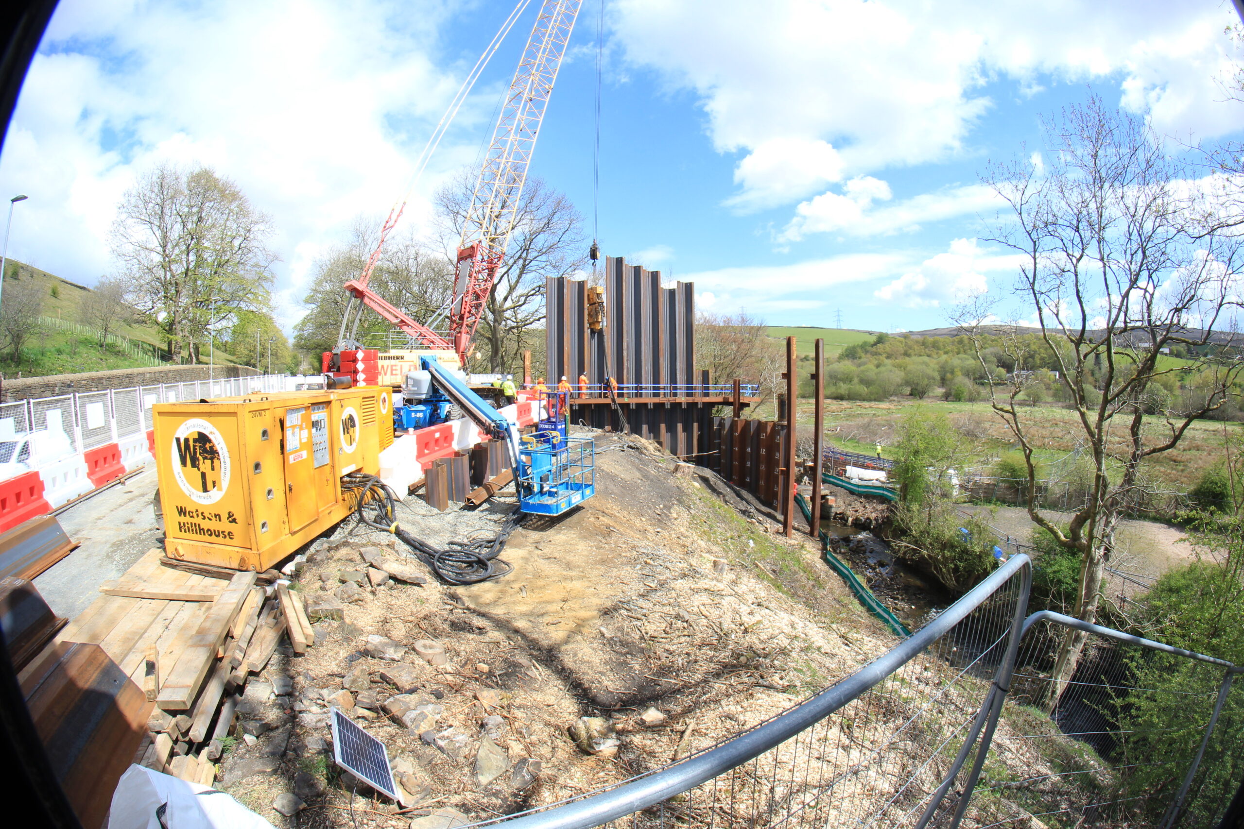
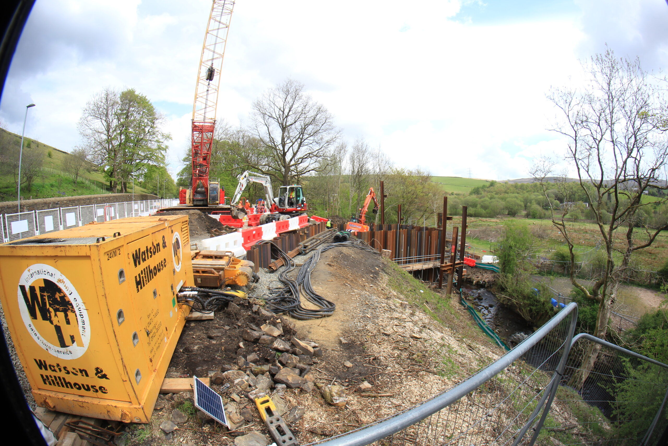
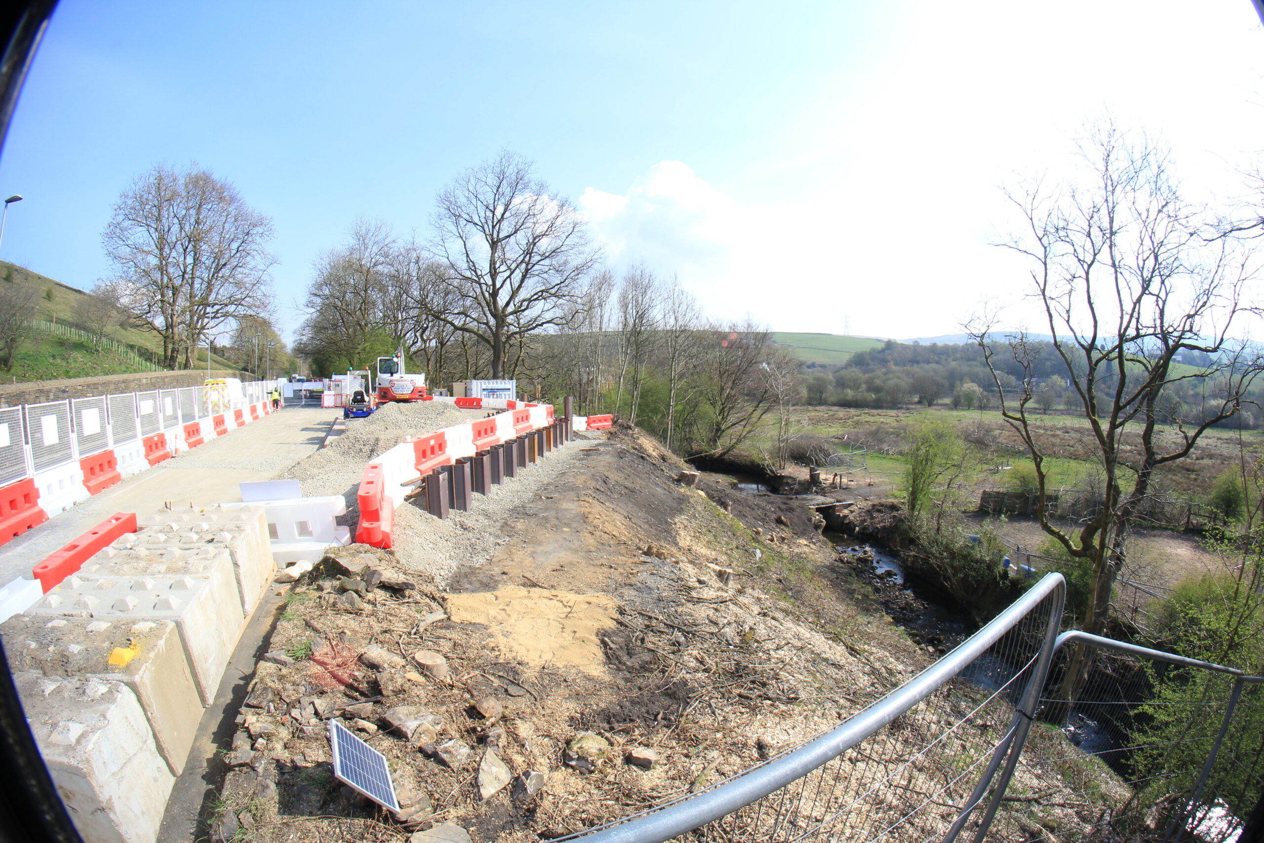
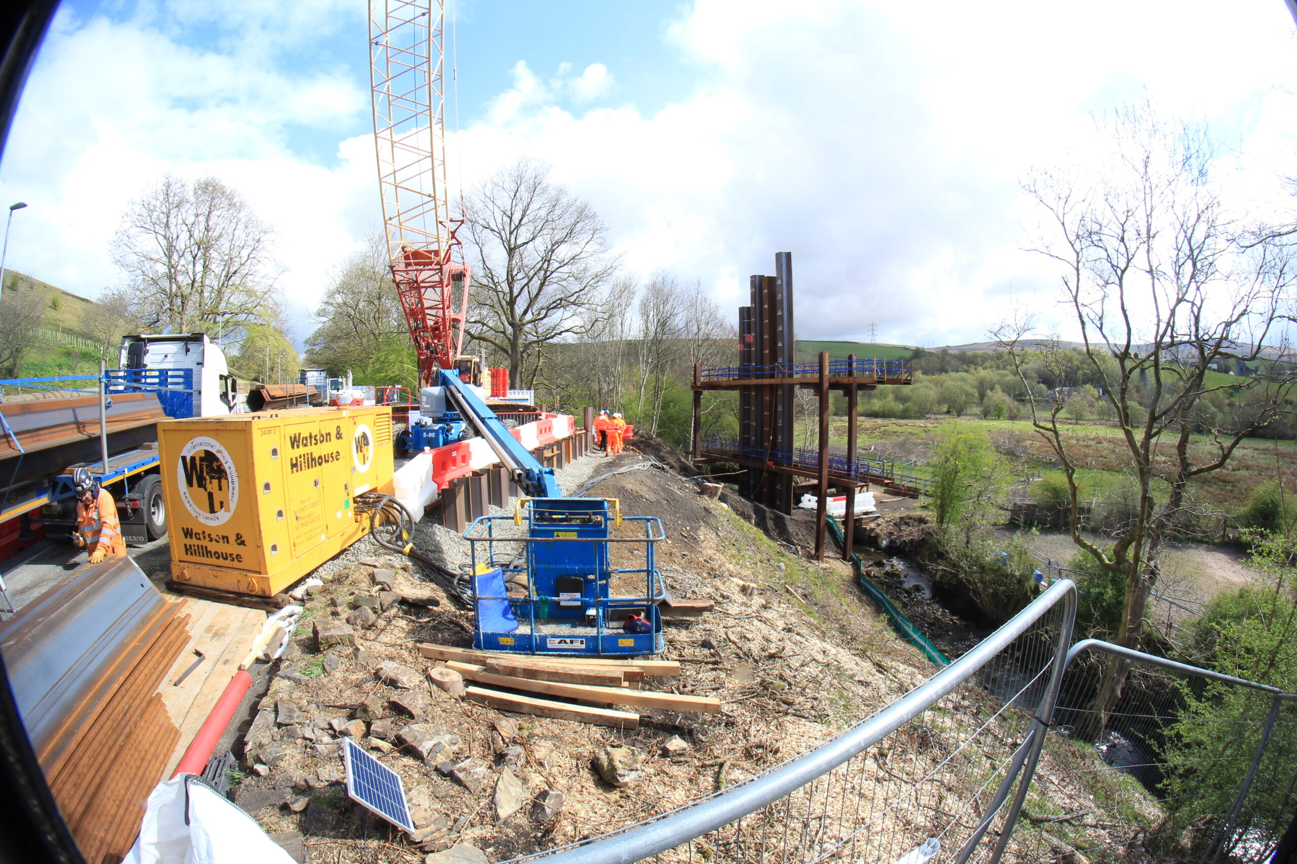
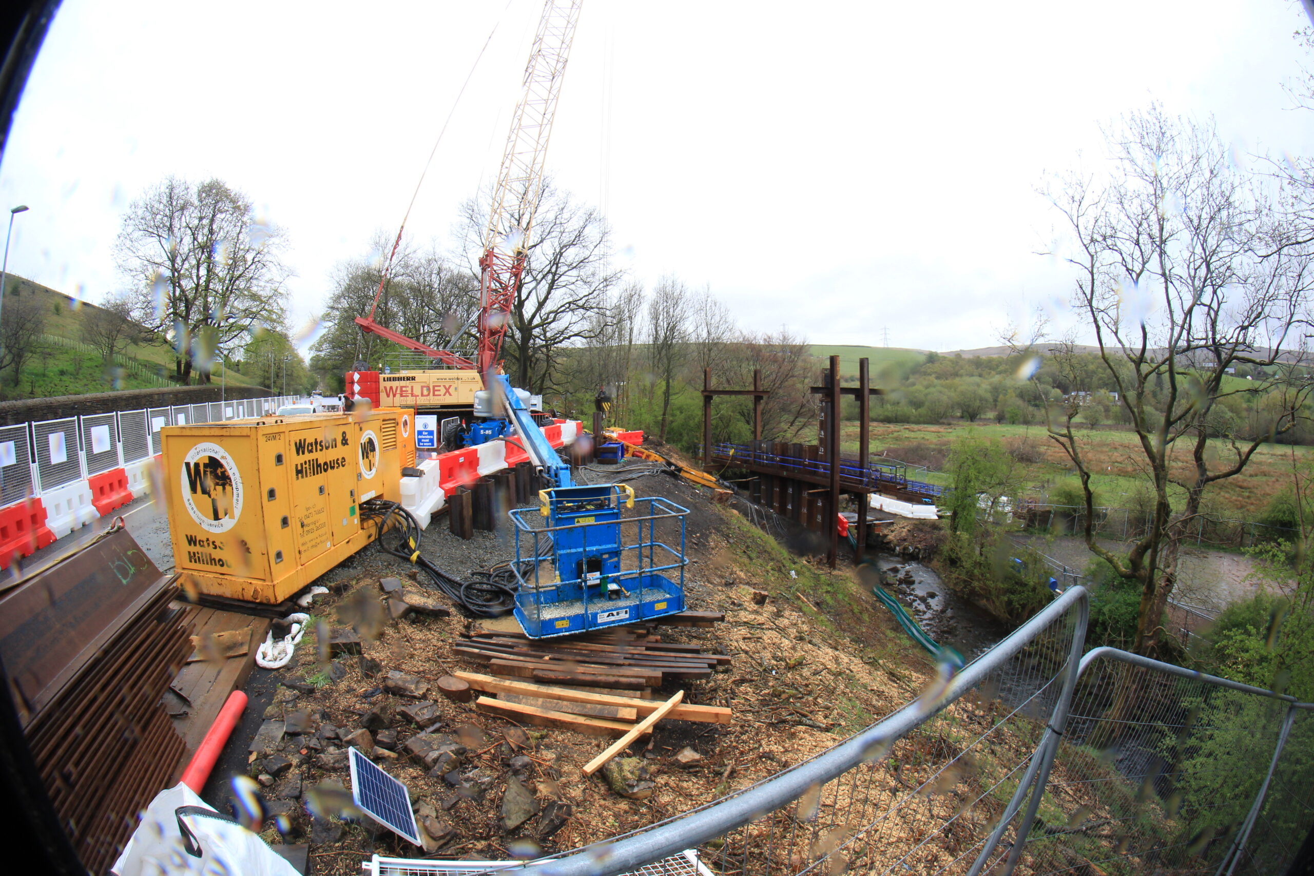
Gale West –. Construction of earth embankments and sheet pile walls to form a flood impounding structure. In addition, the construction of a flow control structure, maintenance track and access track, installation of CCTV, telemetry kiosk, railings and gates.
Gale East – Construction of an earth embankment and diversion structure to create a flood water impounding structure.
Central Vale and Greenvale Business Park – Reinforced earth flood defence embankments and sheet pile flood defences within Greenvale Business Park.
Ealees Brook – Construction of sheet pile walls along south side of channel and landscape reinstatement works.
GNG Foam Converters – Service diversions required prior to Phase 1b works comprising construction of new flood defence wall in place of existing brick boundary wall.
Preliminary detailed design for phase 2 (Rochdale) is now underway and the main detailed design study is expected to start in summer this year – The Environment Agency look forward to engaging with residents, partners and businesses in the area at the same time once they have developed our proposals further.
The proposals include flood storage at 2 sites (land upstream of Albert Royds and land downstream of Smithy Bridge Road). Additionally raised flood defences are required along sections of the River Roch and Buckley Brook.
The Environment Agency are committed to delivering the scheme as quickly as they can and will work closely with Rochdale Borough Council and other partners to ensure they are in a position to start construction works as quickly as possible.
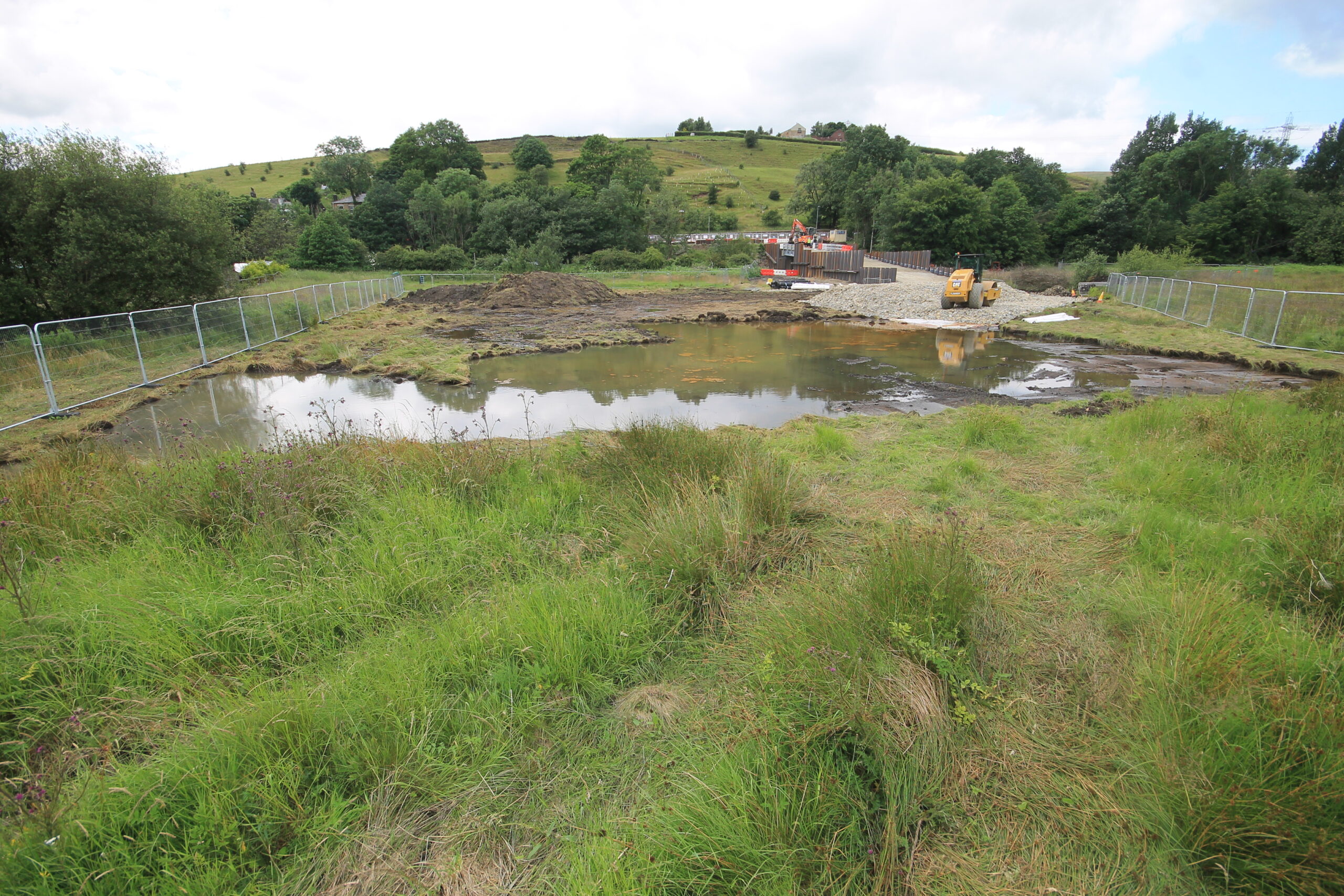
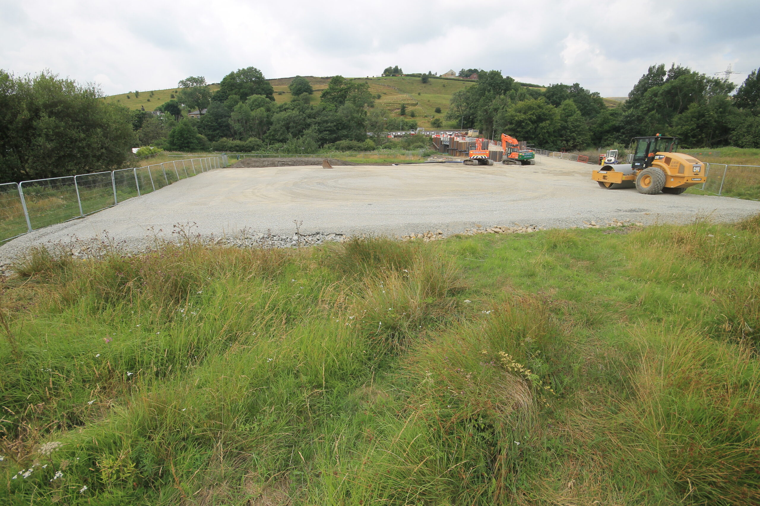
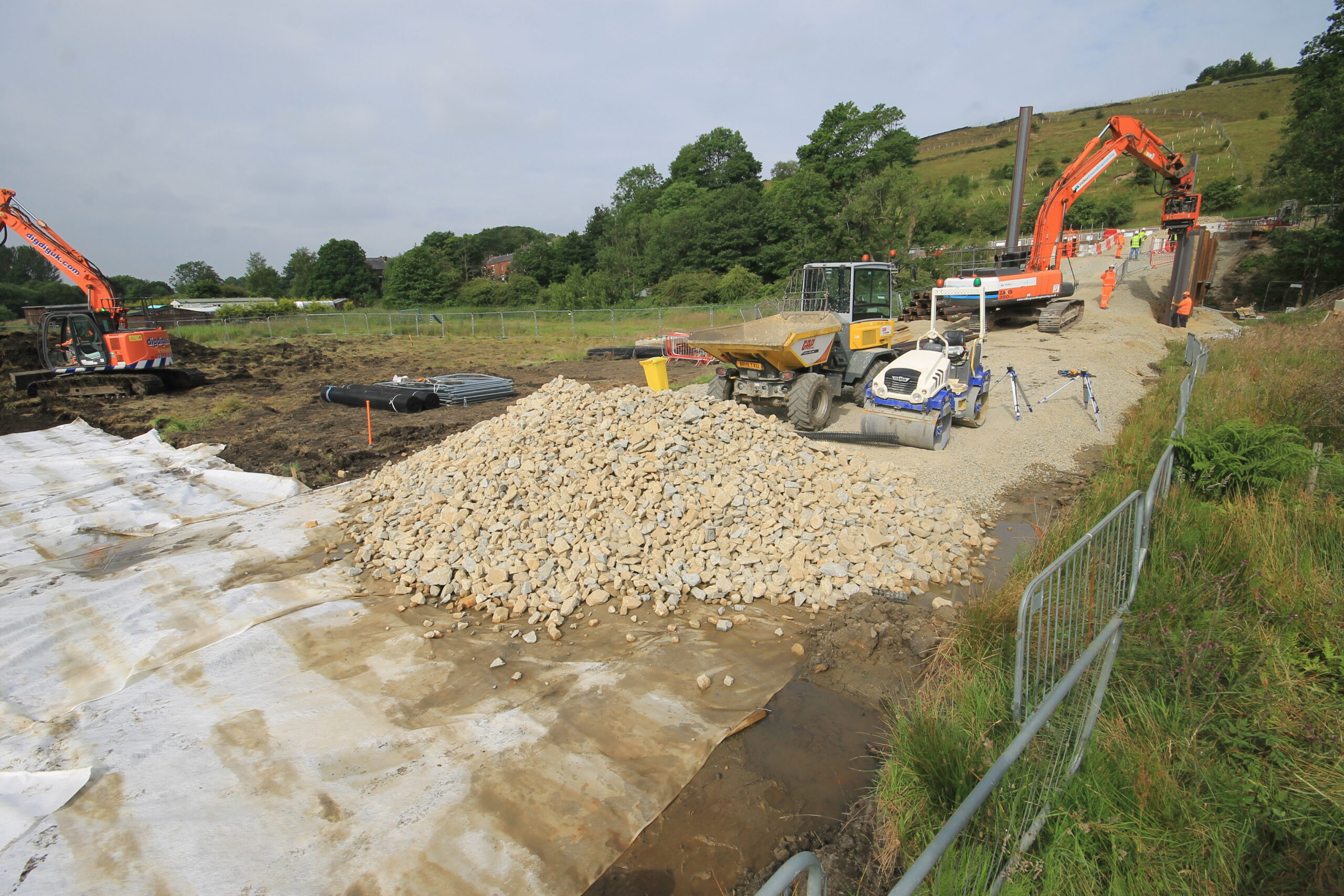
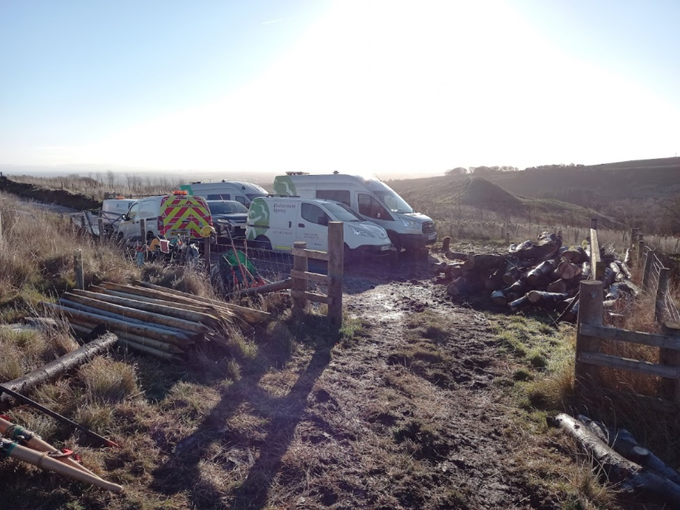
Over the month, The Environment Agency have been working in the Gale area. There have been deliveries of stone for creating their accesses and the working platforms for the construction of the assets associated with the reservoir including the reservoir outlet structure. Noise and vibration monitoring is now underway to ensure they have a record of the impacts of their construction activities on neighbouring properties.
At Grove Lodge, the Environment Agency carried out further site investigation to inform the design of the construction access ramp.
Precondition surveys of properties surrounding the main construction areas have now started and are being undertaken by Brown Rural Partnerships on behalf of the Environment Agency.
Building a working platform for the installation of the reservoir outlet structure at Gale.
Stone deliveries to create the construction access at Gale
At Grove Lodge, the Environment Agency will have traffic management set up on Todmorden Road as work commences to install the access road into the Grove area. Once the access road is in place the Environment Agency will be able to progress ground investigations so that detailed design for the flood walls can be completed. The traffic management will be in place from 29th April for approximately 9 weeks and will be manned between 7am to 7pm. The Environment Agency are exploring the possibility of having the traffic management removed at weekends.
At Gale, once the access roads and the working platforms are completed, they will start the first stage of sheet piling works. This is towards the end of April for a period of about 4 weeks. Noise and vibration readings will be monitored throughout.
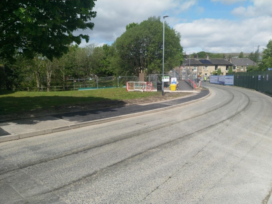
All civil works of Phase 1a of the Littleborough and Rochdale Flood Risk Management Scheme have now been completed with landscaping due to be carried out in Spring of this year.
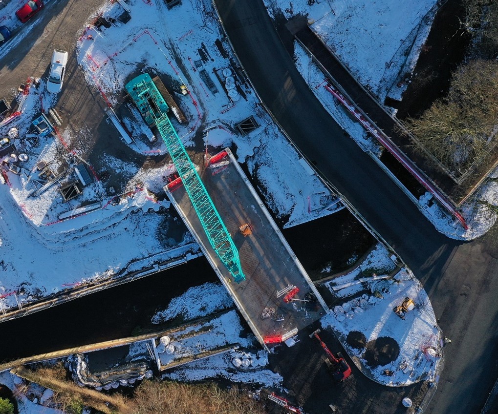
The new 21m single span bridge replaces the existing bridge and footbridge following widening of the river to improve fluvial passage through the centre of the town. Improved flood walls and reinforced embankments provide essential and augmented protection to the community which has suffered from devastating flood events over the years.
Pre-construction photo of site set-up with separate bridge and footbridge

New 21m span bridge following rewidening of river and removal of existing bridge and footbridge
New embankment and road bridge and pedestrian paths

Completed works and site reinstatement
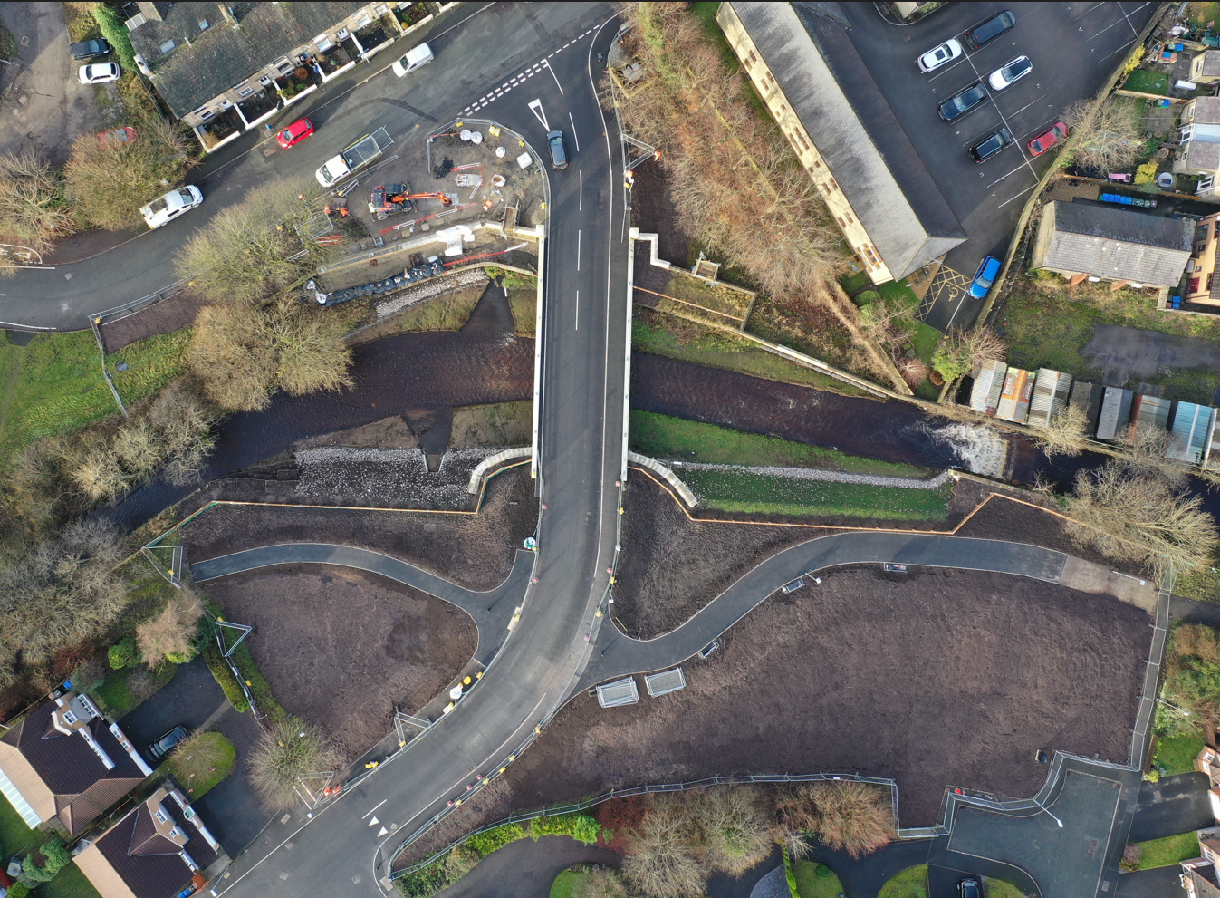
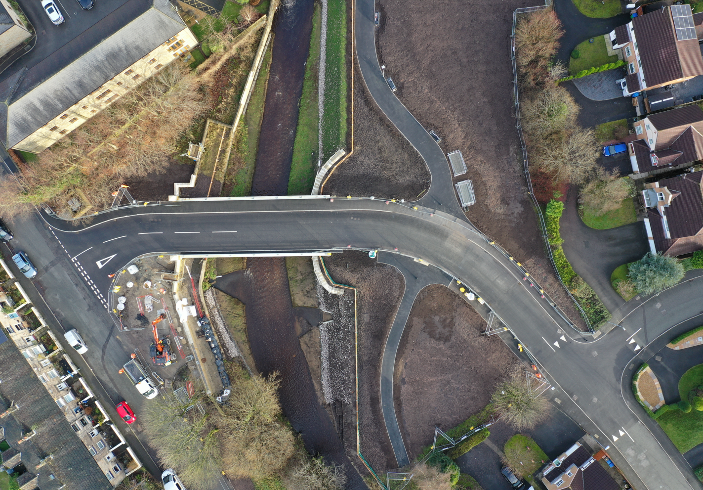
Aerial view of Riverstone Bridge showing ongoing landscaping works
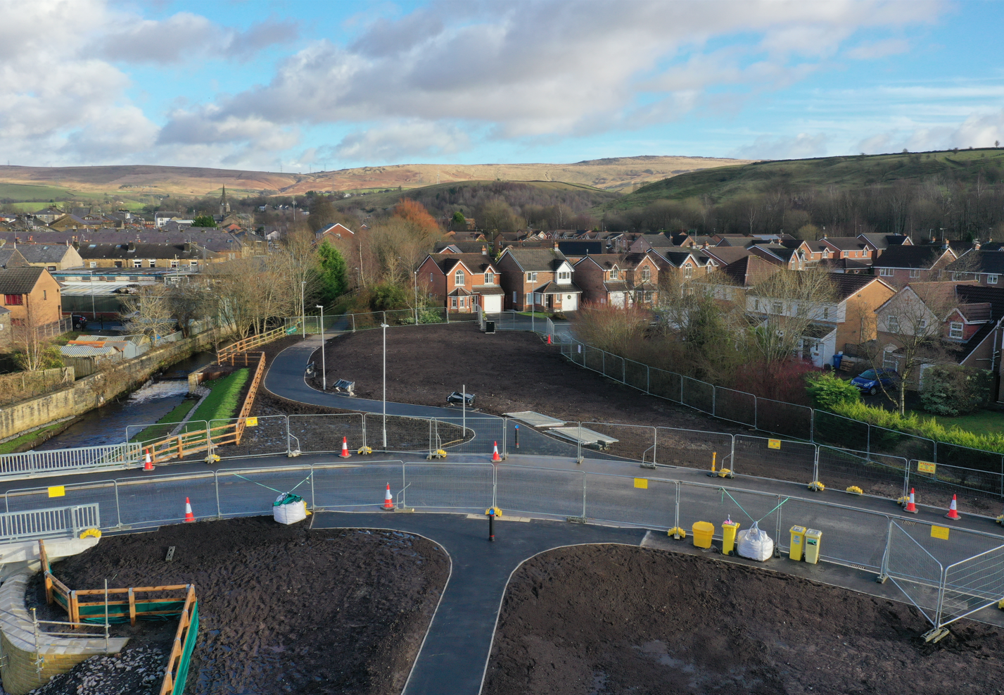
Drone view of south side of Riverstone Bridge showing ongoing landscaping works
Aerial view of Riverstone Bridge showing civil engineering works nearing completion.
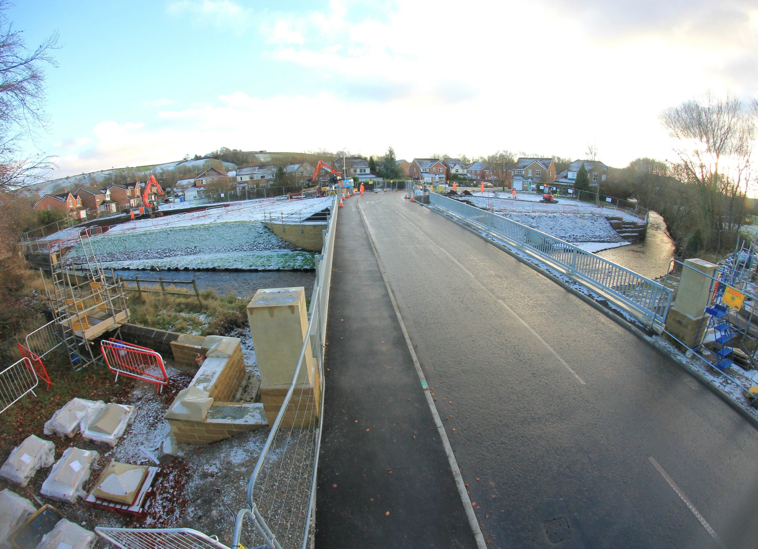
Photo showing initial landscaping work at Riverstone Bridge.
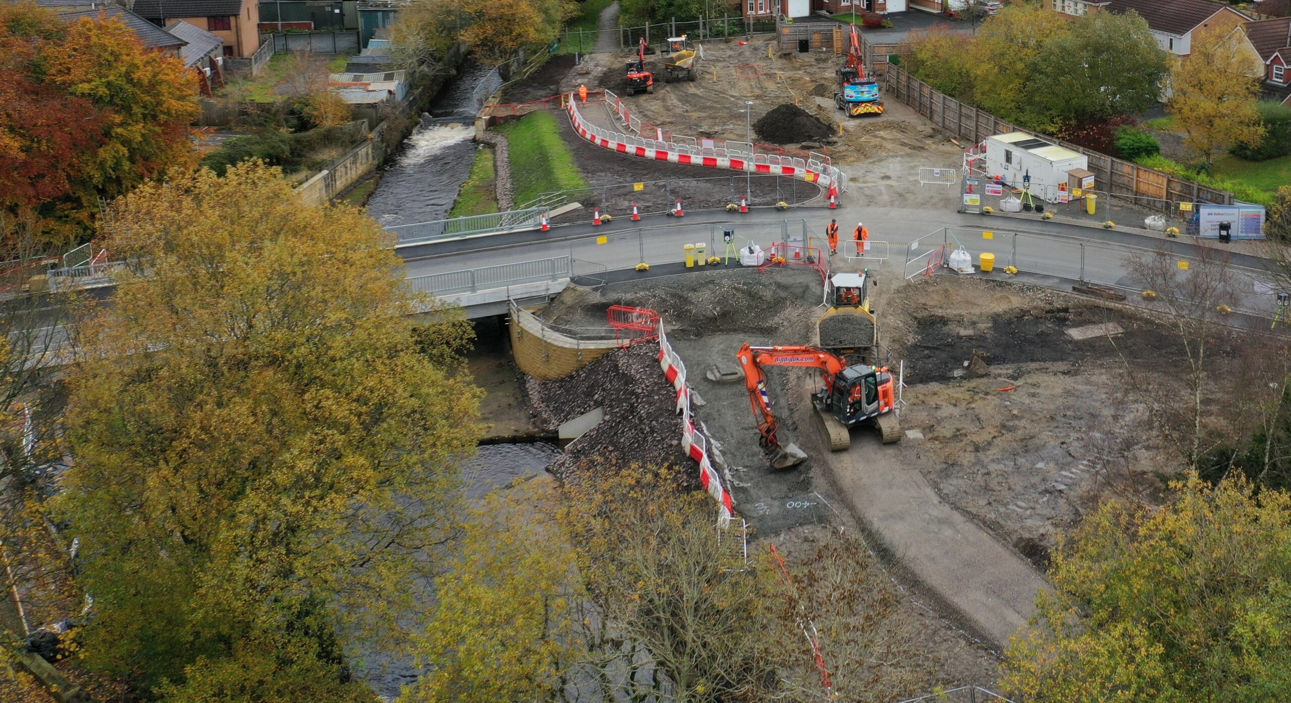
Photo showing civil engineering works nearing completion at Riverstone Bridge.
The Environment Agency are aware of the footpath closure adjacent to Greenvale Brook between the Railway Line and the Rochdale Canal. For further details please contact Rochdale Borough Council Environmental Management department (environmental.management@rochdale.gov.uk).
Please click here to download a letter from VolkerStevin and the Environment Agency about the progress of the work at Riverstone Bridge.
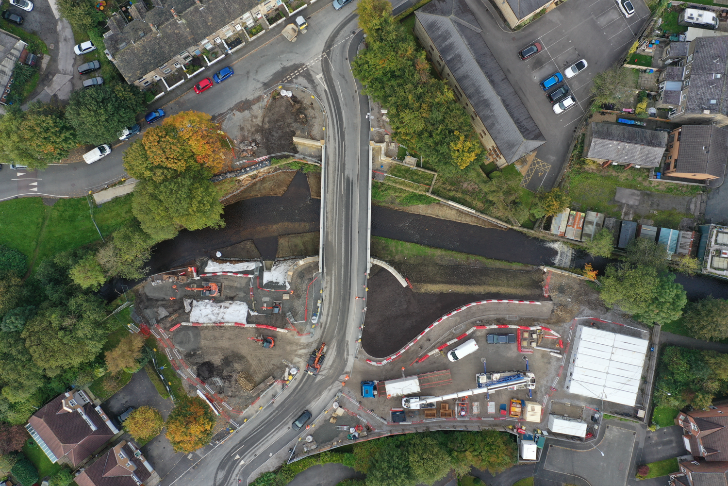
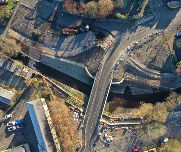
Aerial image of Riverstone Bridge
During June, works took place at Charles Street to remove the existing bridge over the River Roch. The bridge deck was diamond cut before the bridge beams were lifted out by a 150 tonne mobile crane. The pontoons captured debris created in the demolition process and have now been removed from the river. The removal of the bridge removes a constriction to flood flows in the river.
Now that the bridge has been removed a flood wall will be built in its place to connect the adjacent building to the existing flood wall. Associated landscaping and reinstatement works will also take place.
Demolition of the existing bridge at Charles Street
River Roch on completion of demolition
Click here to download the Environment Agency letter about the traffic management as a result of tarmac works to the new bridge and the approach to the bridge.
Last week, Electricity North West were on site to finish the electricity cable diversion at Riverstone Bridge. It is expected to be completed by 23rd May and once installed will allow the planning for the new street lighting to commence. Once the street lighting is installed and the road realignment works complete, traffic will be switched from the old Riverstone Bridge to the newly constructed bridge.
As a wider project update, the Environment Agency team are currently working hard on the Littleborough Phase 1b contract and Full Business Case. Once the Full Business Case has achieved sign off, the Phase 1b contract will be able to commence with much of the work focussed around the Gale site off Todmorden Road which will be converted into a flood storage reservoir.
During April, the Environment Agency and Volker Stevin have now set up the temporary floating pontoons in the river at Charles Street to facilitate the removal of the bridge. The pontoons will capture any debris created in the demolition process.
At Riverstone Bridge, Volker Stevin have been closing the gaps in the flood defence walls and ensuring they tie in with the newly constructed bridge. The image shows the Steel reinforcements which were then subsequently encased in concrete to form the wall.
On Tuesday 11 April the Environment Agency and Volker Stevin will be commencing works to remove the existing bridge that crosses the River Roch on Charles Street. Once removed, a flood wall will be built in its place to connect the adjacent building to the existing flood wall. Noise monitoring equipment is already in place occupying one bay of the parking area.
This week United Utilities have commenced new connections works following completion of the bridge surfacing.
From 13 February, they will begin drainage works at the entrance of the site which will require 3 way Traffic Management at Cutland Way/Riverstone Bridge and Stubley Mill Road at the bridge entrance. The project team anticipate a duration of 5 weeks to complete these works. The project team appreciate how disruptive these works can be and will remove the traffic management when not required.
Aerial view showing bridge progress
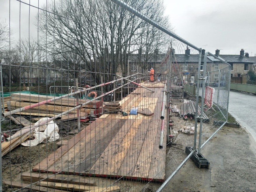
The images below show the progress on the new bridge structure at Riverstone Bridge. The kerbs on the road have started to be installed, as well as the drainage.
The wall that was damaged during the collapse of a previous piling rig has now been repaired on the right bank.

Photo showing the kerb installation at Riverstone Bridge
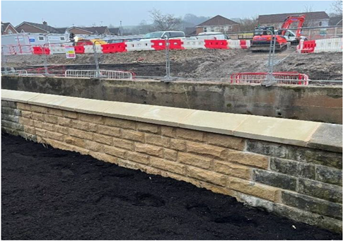
Photo showing the reconstructed wall that was damaged at Riverstone Bridge
Below is some progress photo’s from Riverstone Bridge, which is starting to come together. The photos show parapet rails being fitted to both sides of the bridge, with some concrete finishing. Once the new bridge has been installed, the project team will start on the removal of the old bridge.
The weather last week consisted of heavy downpours and wintery conditions are forecasted for the week ahead.
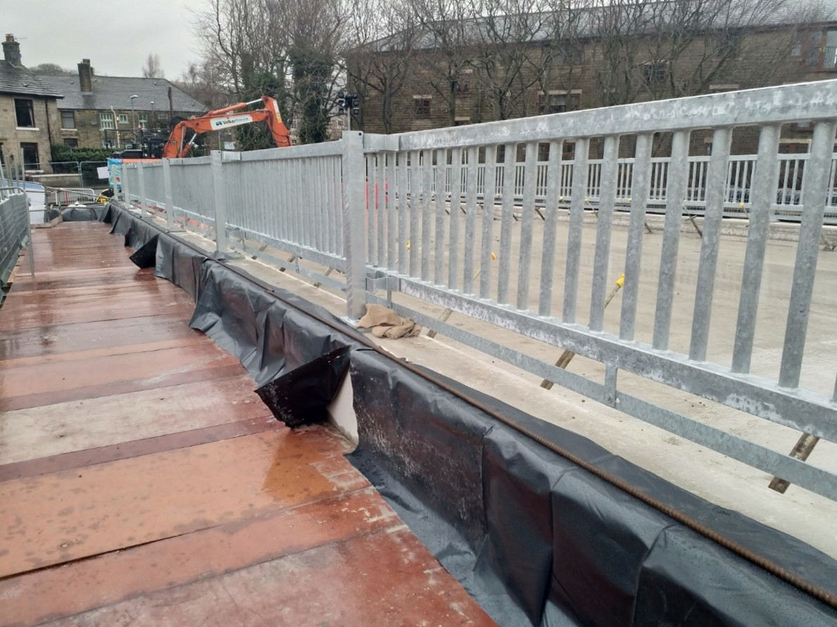
Photo showing the parapets added to each side of the bridge.
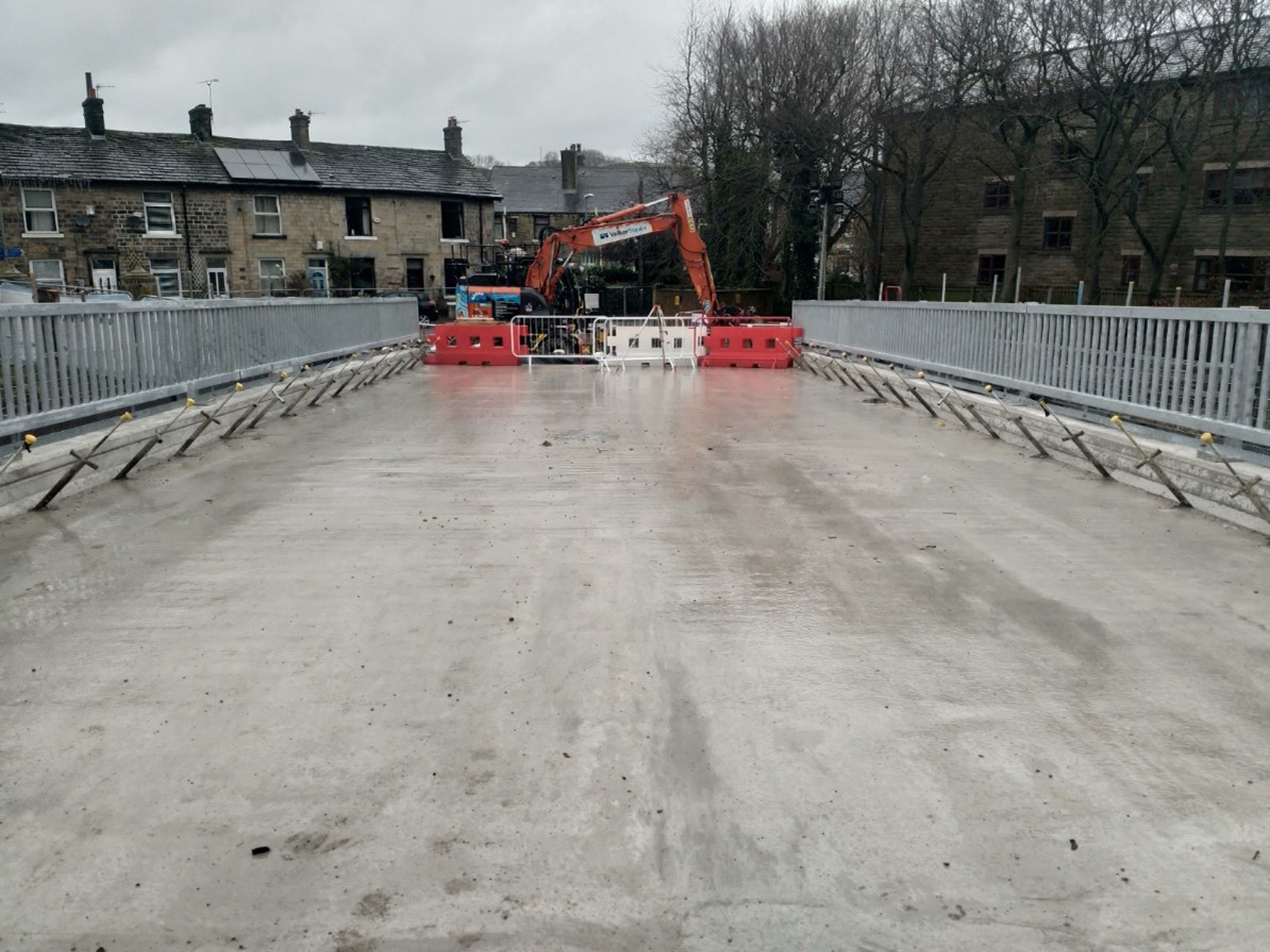
Photo showing the concrete added to the bridge structure.
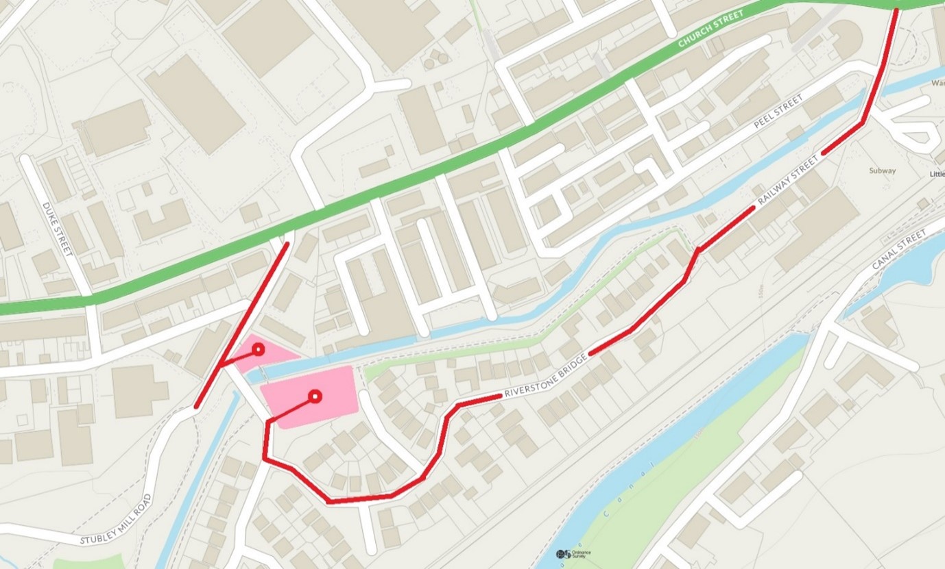
On Thursday 19 January, the 80 tonne crane currently on site will be removed via Railway Street.
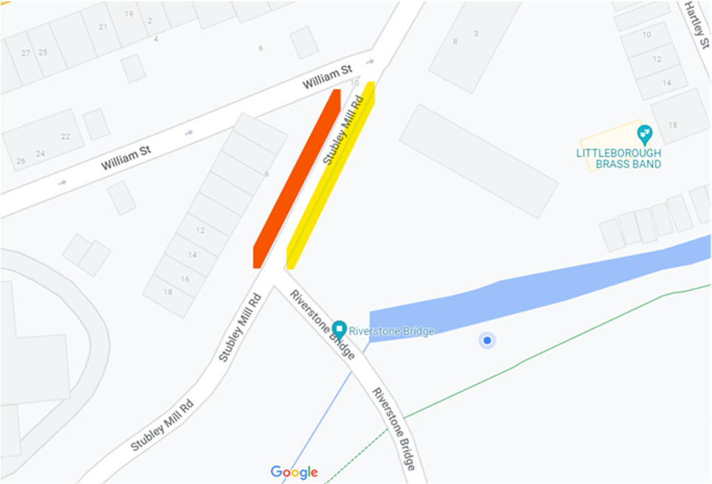
As previously, there will be a Temporary Traffic Regulation Order (TTRO) in place which will prevent parking on the exit route and the site team will be positioning parking cones along the route. Please see map below of route marked in red:

As previously, the bollards at Railway Street will be removed to allow access of the vehicles but will be reinstated immediately.
From 23 January there will be 3 way traffic management in place on Riverstone Bridge for one week to enable essential tree removal and installation of the pedestrian walkway. A TTRO will be in place to restrict parking in this area as traffic will be down to one lane adjacent to the working site.
Highlighted red is parking bay suspension – yellow is a lane closure with TM in place.
Key progress dates:
Happy New Year! The project team hope you had a wonderful festive period, however you choose to celebrate! Monday 9th Jan was the first day back on site after the festive period. 2023 will be a big year for the scheme, with the continuing construction of Riverstone Bridge. This is forecasted to be complete and open by June 2023. Once the construction on the new bridge is complete, the Environment Agency will work on removing the old bridge and diverting the utilities to a permanent location.
The project team look forward to providing you all with more updates throughout 2023.
The image below shows the bridge deck concrete being poured to form part of the new bridge structure.
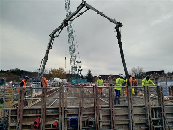
Bridge deck concrete being poured into place
Bridge deck concrete being poured into place
Please note, the Customer Cabin will not be open next Wednesday 21st December.
The Project team would like to wish you a Merry Christmas and a Happy New Year. They thank you for your patience this year, as the works are being carried out.
Please be aware that on Friday 2 December there will be an increase in vehicle movements to and from site as the Environment Agency carry out the concrete pour of the new bridge deck. All access will be via Stubley Mill Road and not Railway Street.
Please take care when entering and leaving the area. Thank you for your cooperation.
If you have any further questions or concerns, please contact Alison on 07392 102093 or by email at Alison.carlton@volkerstevin.co.uk
The Visitor Centre will now be open bi weekly on Wednesday only 3pm – 6.30pm. The new opening schedule will be 7 December, 21 December and 4 January in the new year and so on, effective immediately. The Environment Agency have taken this decision due to the lack of footfall to the visitor centre but if you have any questions or concerns in the meantime, please contact Alison on 07392 102093 or email at Alison.carlton@volkerstevin.co.uk
There will be increased activity on site for the next two weeks. The Environment Agency project team will strive to keep disruption to a minimum and appreciate your patience whilst they carry out these essential works.
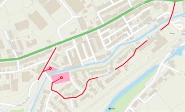
On Tuesday 1 November, a 38 tonne Movax will be arriving on site to remove the piles currently in place in the cofferdam. The vehicle will be arriving via Railway Street.
As previously, there will be a Temporary Traffic Regulation Order (TTRO) in place which will prevent parking on the delivery route of the Movax and crane and the EA site team will be positioning parking cones along the route this evening. Please see map below of route marked in red:

Map showing Temporary Traffic Regulation Order (TTRO)
As previously, the bollards at Railway Street will be removed to allow access of the vehicles but will be reinstated immediately. The EA anticipate that the Movax will exit site on Thursday (3rd).
The following week a 450 tonne crane will arrive on site on Monday 7th November via the same route to allow the new bridge beams to be installed along with multiple deliveries for the beams over three days 07th, 08th & 9th. The purpose of the bridge beams is to enable construction of the new bridge. This crane is due to leave site Tuesday 14th November via Railway St. If progress is made then the crane will leave prior to the 14th November 2022.
If you have any further questions or concerns, please contact Alison on 07392 102093 or by email at Alison.carlton@volkerstevin.co.uk
The Environment Agency project team visited Shay Murtagh’s precast facility in Mullingar, Ireland where they viewed 11 prestressed concrete bridge beams that have been cast for Riverstone Bridge. The image below shows the first batch of 5 of the T-beams and 2 Edge Beams. Each beam has undergone thorough QA inspection and has a unique QR code assigned for the Littleborough Project. The beams are what the road will sit on top of, they are laid side by side, resting on the foundations that have been built either side of the river.
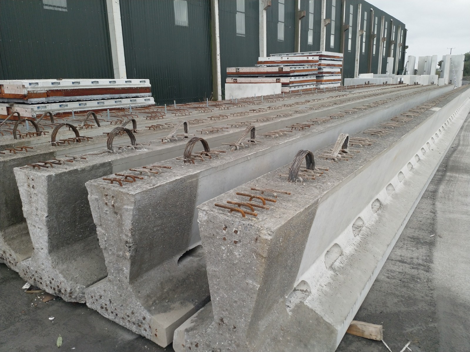
Picture showing beams to be inserted as part of Riverstone
In the image below you can see that the installing of sheet pile walls has begun. They are being vibrated into the ground using a movax machine, which is attached to the excavator. A wing wall is a smaller wall attached (or next to) a larger wall or structure and in this case, will form part of the new Riverstone Bridge.
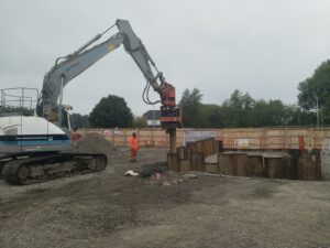
Image showing the movax inserting the new sheet piles at Riverstone Bridge
The customer cabin opening times and dates have now been updated to the following:
The cabins can be accessed via Stubley Gardens. Members of the Environment Agency project team will be present to answer any questions or queries you may have regarding the project.
The next stage of the flood defence works is due to commence next week when the sheet piles for the wing walls of the new bridge will be installed. Sheet piles are sections of sheet steel with interlocking edges that are driven into the ground to provide earth retention and excavation support. Vibratory hammers are used to install sheet piles which is quite audible. You may notice some elevated noise levels for short durations but these will remain within acceptable limits. Both noise and vibration monitors have been installed around the site to ensure permissible limits are not exceeded and will be carefully monitored throughout. A short section of Traffic Management will be in place on Riverstone Bridge when the sheet piles are being installed but only for those periods and for a maximum of three days and will be removed each evening. The piling rig and crane will be delivered to site week commencing 12th September and removed the following week on completion of the works.
As previously, there will be a Temporary Traffic Regulation Order (TTRO) in place which will prevent parking on the delivery route of the piling rig and the Environment Agency site team will be positioning parking cones along the route on affected days. Please see map below of route marked in red: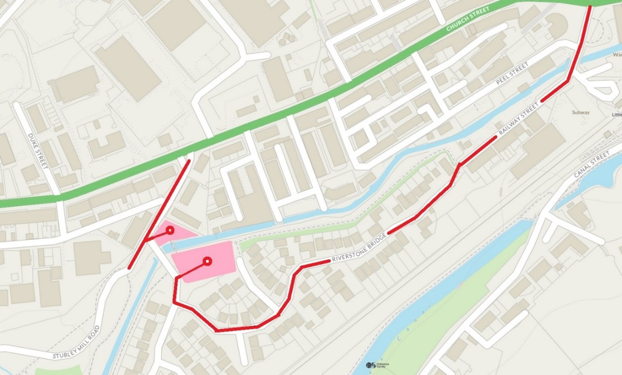
As previously, the bollards at Railway Street will be removed to allow access of the piling rig but will be reinstated each evening.’
‘The majority of works at Townhouse Brook are now completed, with handrailing and reinstatement works still outstanding. Following this, the Environment Agency will be reopening the Public Right of Way. Please check back here for any updates.
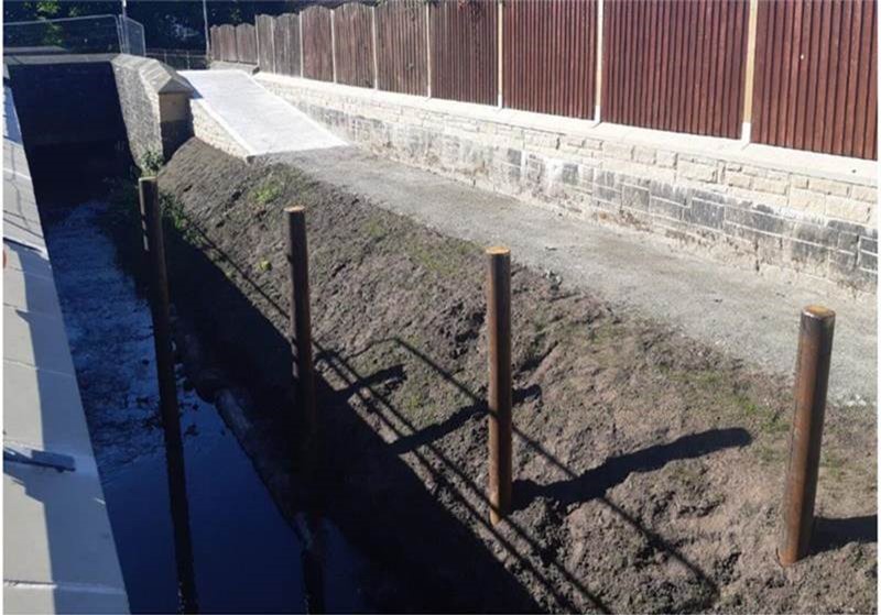
Trash posts now installed at Townhouse Brook
Following recovery of the overturned piling rig and its removal, the replacement piling rig will be delivered to site on Monday 22 August in the morning.
As previously, there will be a Temporary Traffic Regulation Order (TTRO) in place which will prevent parking on the delivery route of the piling rig and the site team will be positioning parking cones along the route. Please see map below of route marked in red:
Piling works will recommence for the North bridge abutments following set up of the rig.
As previously, the bollards at Railway Street will be removed to allow access of the piling rig and delivery of steel reinforced cages but will be reinstated each evening.
On completion of these piling works, the same routes will be used to remove the piling rig and crane and a TTRO with the same parking restrictions will be in place. The confirmed date will be published on The Flood Hub nearer the time. The Environment Agency project team would like to take this opportunity to thank you for your cooperation and patience so far as they appreciate how disruptive these works can be.
The works at Townhouse Brook are nearly complete. All that is left to do is a hand rail needs to be fitted and some stone steps removed.
The recovery of the piling rig is taking place this week on Monday 1st August, from 6am. Three cranes will be arriving on site via Railway Street using the same route as previously to remove the piling rig. Once the rig is removed the cranes will then leave site which is anticipated to be at the end of the week.
The customer cabin will also reopen on Monday 1st August at 10am and normal hours will resume. As a reminder these are:
Please see the ‘Newsletter’ section for information about the recovery of the piling rig.
’Please see the Newsletter section for more information on the incident with the piling rig on Monday 18th July
As mentioned previously, the piling rig will now be on site Monday 11th July. The piling rig and crane will be delivered to the Riverstone Bridge site via Railway Street and Stubley Mill Road at 6am and 8am respectively, on the morning of the 11th July. As previously, there will be a Temporary Traffic Regulation Order (TTRO) in place which will prevent parking on the delivery route of the piling rig and the site team will be positioning parking cones along the route. Please see map below of route marked in red:
Map of piling rig route
Now that fish spawning season has finished, the in channel working window has opened. The Environment Agency project team can now begin installing trash posts into the river. The trash posts are a vertical post that are then installed in the channel and are designed to capture heavy debris, branches of trees etc, in order to reduce risk of blockages.
The piling rig that has been mentioned previously is due to come back onto site around early to mid July. The Environment Agency will update the Flood Hub page nearer the time with more information.
United Utilities have now completed their diversion works at Riverstone Bridge and currently, GTC Gas are on site installing a temporary gas main. Once the temporary diversions have been completed construction can begin to install new piles, that will support the foundations for the new bridge to sit on.
Also, a reminder that the Riverstone Bridge Customer Cabin is open on Monday’s 10am – 12pm and Wednesdays 12pm-2pm and 5pm-8pm, where you can come along and meet our customer liaison contact, Alison.
A new customer experience co-ordinator, who works for Volkerstevin will now be a point of contact for residents to discuss the Rochdale and Littleborough project or raise any questions. She will also be present at the customer drop in cabins on the dates listed above, as well as out within the community.
Please click here for her contact details.
The Environment Agency customer drop in cabins now have revised opening hours and days, the week commencing 23rd May 2022. The new opening dates and times will be Monday 10am – 12pm, Wednesday 12pm – 2pm and Wednesday 5pm – 8pm. Again, the cabins can be accessed via Stubley Gardens. Members of the Environment Agency project team will be present to answer any questions or queries you may have regarding the project.
Electricity Northwest have now completed their works at Riverstone Bridge, where they were temporarily diverting their services so that they are out of the way for construction works. This will coincide with the test pile passing it’s testing, so the remaining piles can now be installed once all services are temporarily moved. The piles will provide support and new foundations for the new bridge to sit on.
Electricity North West completed their temporary moving of their services.
The Environment Agency have been undertaking key works at the Riverstone Bridge site with the arrival of a crane and piling rig on Monday 25th April. The works involved drilling deep into the ground to install a concrete plug and steel frame. This work was undertaken to ensure the ground is suitable to support the load of the new bridge the Environment Agency will be installing across River Roch in the months ahead. The works started Monday 25th April with the careful manoeuvring of the heavy plant needed for the operation through Railway Street and the housing estate. This was necessary due to weight limitations on the existing bridge crossing the river off Stubley Mill Road. Works were completed and the plant taken from site on Friday 29th April.
The project team at the Environment Agency took the opportunity to capture some drone footage of this operation to show the works and the challenges they had to overcome particularly with the limited access available to bring in the plant.
The piling rig on site at Riverstone Bridge.
The piling rig being delivered through a tight entrance.
The piling rig will be leaving the Riverstone Bridge site on Friday 29th April. The same parking restrictions will apply to Riverstone Bridge and Railway Street, whilst the machinery is removed from site.
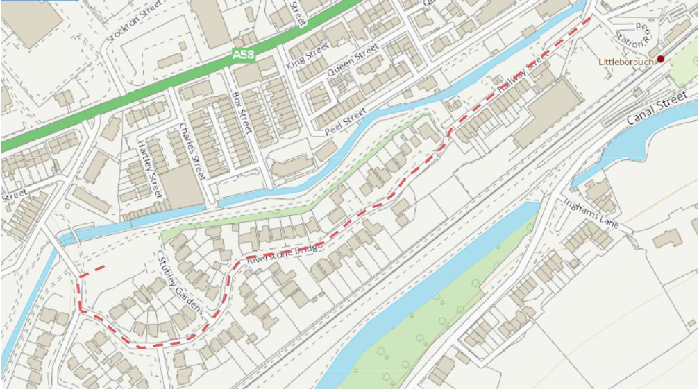
Map showing the route the piling rig will take
The customer drop in cabins will be starting from week commencing 25th April, with the first drop in on Tuesday 26th April. The drop in cabin will be open from 10am – 12pm, every Tuesday and Wednesday and can be accessed via Stubley Gardens. Members of the project team will be present to answer any questions or queries you may have regarding the project.
Over the next month, the project team are now reliant on utilities companies to divert existing services around the Riverstone Bridge area. This will ensure the area is clear of services before piling works begin.
A reminder that the piling rig is due to be onsite the week commencing the 25th April. The project team will out early in the morning, distributing cones in the street. There will be no parking within this area. Please see the map above for further details of the route the piling rig will take.
The planning application for Phase 1B was submitted on the 6th April and can be found via the link on the Planning Applications section on the flood hub. The Environment Agency welcomes any comments as part of the formal process to Rochdale Borough Council.
The compound at the Gale west site that will be servicing Phase 1a and Phase 1b work packages, is now completed. The compound is fully operational with welfare facilities for the onsite staff.
In order for the next stage of the works at Riverstone Bridge to move forward, a piling rig – a significant piece of heavy machinery – is required. Due to its size, the piling rig will be delivered through to Riverstone Bridge Estate via Railway Street on 25th April. As part of this, the Environment Agency project team will be putting cones out in the street early on the morning of the 25th April. There will also be a Temporary Traffic Regulation Order processed with the council preventing parking on the street to allow the piling rig to be moved safely. Please see the map below for the route that the piling rig will take. The Environment Agency will update here when the piling rig will be coming back out.

Map showing the route the piling rig will take
The planning application for Phase 1b has been submitted to Rochdale Borough Council, on 6th April 2022. Once this has been validated, it will become visible on the council planning portal. The Environment Agency will also put a link to the planning application page, here on the Flood Hub. The Environment Agency welcome any comments as part of the formal process to Rochdale Borough Council.
A temporary pedestrian bridge has now been installed at Riverstone Bridge and is open for public use, this will be in place until the bridge works in the area are complete. Also, at Riverstone Bridge the hoarding which surrounds the site has been painted in Environment Agency colours and site cabins have been delivered.
Forecasted for the middle of April, the Environment Agency will be bringing piling rigs onto the site. These will be used to assist the placing of bridge footings for the new bridge installation. Further communication will be sent out to the residents of Riverstone Bridge. Finally, an artist’s impression of what the bridge will look like upon completion is due to be released soon. Please check back here for further updates.
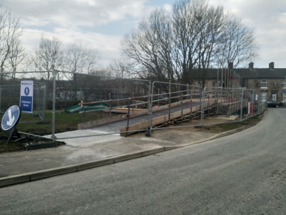
New temporary pedestrian bridge installed at Riverstone Bridge
Scaffolding has been established in the river channel to enable the works to be completed along the flood wall. The wall rising is due to commence the end of March 2022.
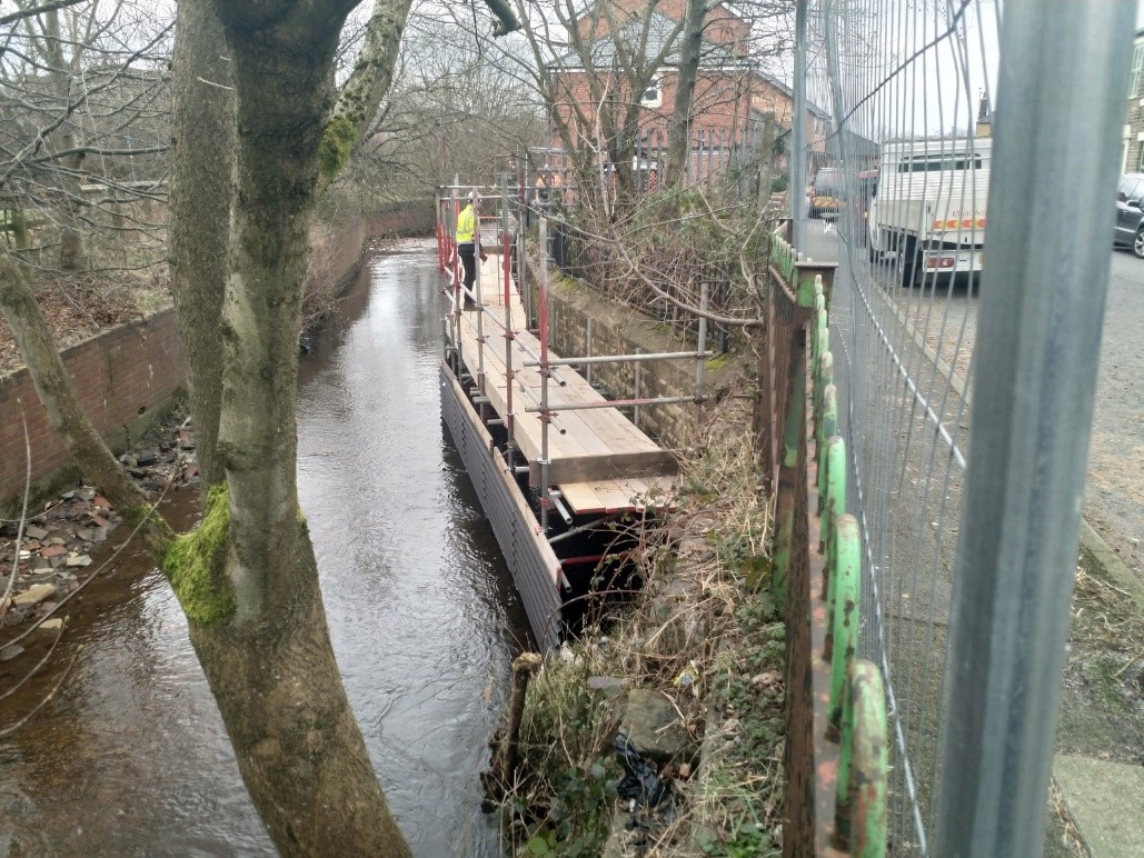
Scaffolding installed along the river in order to begin wall raising.
The Environment Agency are hosting a drop in event on Thursday 17th March 2022 at The Coach House; Heritage Centre; Lodge St; Littleborough; OL15 9AE. The drop in will be focusing on Phase 1b works, in advance of the planning application being submitted in Spring 2022. The Environment Agency project team will be in attendance at the event to answer your questions about the flood risk management scheme, however they are happy to address any questions or concerns about the project, as a whole. The Environment Agency will be sending out a letter to local residents with information regarding the drop in session and an invite to view the latest newsletter on the Flood Hub page.
On 9th March 2022, cabins will be being delivered to the Riverstone Bridge site for both the Environment Agency site team to utilise and for customer drop in cabins. Once installed, the customer drop in cabins will become a regular spot for members of the public, to ask any questions for the Environment Agency’s project team. Once these have been installed and are up and running, the Environment Agency will update The Flood Hub page with regular drop in dates and times.
View from our site camera of the site and cabin
As part of works at Riverstone Bridge, the Environment Agency were looking to identify where existing buried services where located. It was important to locate the buried services before below ground works commenced, to ensure that no damage was done to services. One service, the gas main, was particularly tricky to locate. The Environment Agency brought Vac Ex machines on site which allowed for excavation without damaging surrounding services. They dug trial holes to find the gas main and as a result, the Environment Agency were successful in finding it on Friday 4th March. The Environment Agency can now safely divert it away from the working area in readiness for the new bridge.
The Environment Agency has now made progress on the works at Townhouse Brook with the customer fencing being removed to enable us to begin raising the existing flood defences. They have been stored in order to be reused once this section is completed. Also, at Townhouse Brook, a masonry wall is being built up on both sides of the river and the footpath has been reinstated.
Customer fencing removed to begin raising of existing flood defences
The site team have been working hard at Riverstone Bridge to install the temporary footbridge and service bridge. Pictures of the progress are shown below. On Monday 28th February, the site team will be closing the existing footbridge and diverting all foot traffic across the new temporary bridge. The temporary bridge has been designed to ensure all pedestrian traffic, wheelchair users and pushchairs/prams can use the bridge safely.
Temporary bridge being installed at Riverstone Bridge site
There has been a number of enquiries to the Environment Agency recently in regard to tree removal as part of the project. The Environment Agency and their contractors limit tree removal to those absolutely necessary where they are physically in the way of construction works or where they pose a safety risk. The Environment Agency work with their contractors to ensure all other trees in the vicinity of the construction works are protected with measures such as root protection and temporary fencing. Upon completion of the construction works, a full reinstatement and landscaping plan will be undertaken, this includes replanting of significant numbers of trees where there has been necessary tree loss as part of the scheme. The landscape plans were submitted to Rochdale Borough Council as part of the Planning Application and can be viewed on the planning portal.
Finally, following the bad weather of the last week, the Environment Agency would like to remind members of the public that even with flood defences in place, you can never entirely remove the risk of flooding. It is important that you prepare for this by signing up for free flood warnings, related to river levels, by phoning Floodline, on 0345 988 1188, or by going to online: Sign up for flood warnings – GOV.UK (www.gov.uk)
The Environment Agency have started work at Townhouse Brook which is a part of Phase 1A. Here existing flood defences will be raised to give a higher standard of protection from flood risk and will help to reduce climate change. Once finished, the Environment Agency will also begin to re-landscape the adjacent public right of way.
Concrete being placed for extending wall footings at Townhouse Brook.
The Environment Agency are pleased to confirm that the new Culvert under the railway at the Gale site in Littleborough has been successfully installed. The culvert was installed by Network Rail and their contractor, J Murphy and Sons, in a 72 hour blockade of the railway and it will form a vital part of the proposed flood storage reservoir at the site. A time-lapse video was filmed during construction:
Not only will this work help to protect people, property and the environment, key infrastructure such as the railway will also receive a greater standard of protection from flooding on completion of the scheme.
Network Rail have now finished their works on site and have handed back over to the Environment Agency who will be focussing on Phase 1a construction and the continued design of Phase 1b in the New Year. Look out for fortnightly updates on this page, or if you have any questions, please email RochdaleAndLittleborough.FAS@environment-agency.gov.uk and one of the team will get back to you as soon as possible.
The Environment Agency are now beginning to progress works for the Littleborough Phase 1a part of the Flood Risk Management Scheme. The first task that needs to take place prior to construction works is tree and vegetation clearance. The majority of the vegetation and tree clearance will take place around the Riverstone Bridge work area, but there will also be some minor vegetation clearance around Charles Street, Peel Street, GNG Foam Converters and Townhouse Brook.
All the trees and vegetation will be checked by an ecologist prior to removal to check for any birds and wildlife. The Environment Agency will only be removing trees that are preventing construction of the Flood Risk Management Scheme and all remaining trees within close proximity to the work areas will have root protection zones in place during construction.
The timber that is removed from site will all be reused for Natural Flood Management where it will be used to create leaky dams on the hills above North Manchester. Once construction works have been completed there will be significant landscaping of the work areas involving the replanting of trees which will be a range of maturity, sizes and native species.
If you have any questions, please feel free to contact the Project Team via the email address in the Contact Us Section.
Final Drone footage showing completed Littleborough Enabling Works.
The Environment Agency are pleased to announce the completion of the Enabling Works at the Gale site in Littleborough. On the 3rd September 21, the Environment Agency’s contractor Volker Stevin demobilised from site and handed the site over to Network Rail and their contractor J Murphy & Sons.
Network Rail will have control of the Gale site from 6th September 21 until 6th December 21 to install a new box culvert under the railway during a planned closure of the railway line at the end of October. For any enquiries about the works on site during this time, please direct them to Network Rail on 03457 11 41 41 quoting the project reference MVN2 – Littleborough.
For any questions about the wider flood risk management scheme, please continue to direct these to the Environment Agency on RochdaleandLittleborough.FAS@environment-agency.gov.uk

Completed Gale West Compound where J Murphy & Sons and Network Rail have mobilised to start the new culvert works.
The Environment Agency has some great news to report this week, the Gale West Enabling Works are complete. This means the traffic management on Todmorden Road has been removed 3 weeks ahead of the original planned schedule. The Environment Agency wishes to again thank the community for their patience while these works were being undertaken.
The works on Gale East are also coming to an end for the Enabling Works phase with the final site tidy and demobilisation happening over the next 2 weeks.
On Completion of the Enabling Works, the Environment Agency will shortly be handing over the site to Network Rail and their Contractors to install a new culvert under the railway line. This culvert is a critical new asset for the future flood storage reservoir planned for the Gale site which will hold water back and slow the flow of the River Roch and Greenvale Brook into Littleborough town centre.
Please note, updates to the flood hub will now be taking place monthly rather than fortnightly, but the frequency of updates will increase again as the Environment Agency begin the construction works of Phase 1a. If you would like to get in touch with the Environment Agency during this time, please refer to the Contact Us page on the Rochdale and Littleborough Flood Hub page.
This month the Environment Agency’s contractor Volker Stevin has faced some challenges up at the Gale site in Littleborough, primarily due to the weather. There has been some really dry weather which meant the ground became very dry and dusty. The dust was successfully managed on site using water sprays and a road sweep to keep the highway clean and tidy.
The dry weather was coupled with some very wet weather leading to a lot of the site becoming waterlogged. Some of the site resembled a lake rather than grassland! The team on site were able to manage this excess water issue and progress with finishing up the compound area on the Gale West site.
The watercourse diversion of Greenvale Brook on Gale East is progressing well, and the sewer diversion within the field is also near to completion with final tie ins and surveys being undertaken this week.
Despite the challenges this month, the enabling works are due to finish ahead of the original programme around mid to late August. This is down to the ongoing hard work from the team on site.
View from Gale West towards Todmorden Road new access ramp – particularly wet ground following heavy rainfall
Completed compound area within Gale West.

Ongoing bridge construction at Gale West
Ongoing construction of watercourse diversion at Gale East
The key activity that has taken place since the last update is that the new Bailey Bridge has been lifted into place by the crane to sit on top of the piles at Gale West access ramp. This means the Environment Agency are now very close to having a completed bridge for construction vehicle access into Gale West.
Works on Gale East have consisted of the setting up of the compound and site fencing, digging out the new Greenvale Brook channel which brings the watercourse into the middle of the field and also the construction of new manholes and sewer diversion.
Over the next 4 weeks the Environment Agency and their Contractor aim to finish all piling works for the enabling works, complete the haul road and compound area within Gale West and surface the bell mouth (where the Access ramp and Todmorden Road meet). The final works are then forecast to complete in August.
The Environment Agency will also be undertaking some topographical surveys within Reddyshore Brow and Shottwood Fold to inform the further detailed design of Phase 1b.
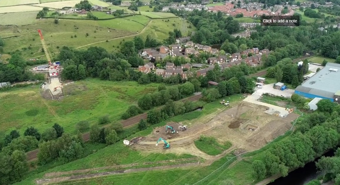
Image captured by drone of the Gale site
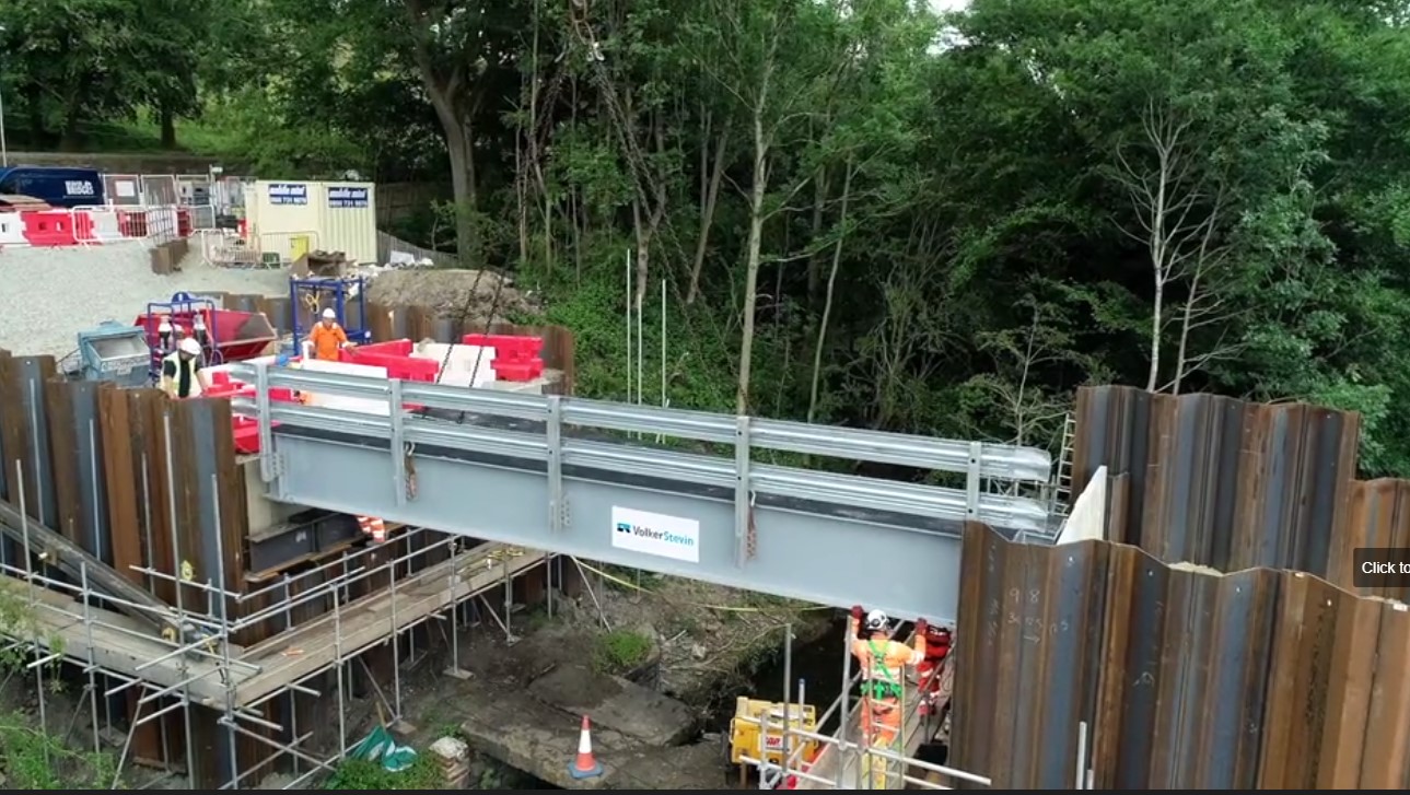
Gale West – Bailey Bridge installation
Gale West – Final piling works taking place on temporary bridge structure
‘Ongoing works at Gale West and Gale East sites.’
Works have been continuing at Gale West, with the majority of the piling works now been completed in readiness for the temporary bridge to be lifted into place with the crane next week.
Gale East works have started, a short section of Greenvale Brook was temporarily dried out and overpumped including a fish rescue (approximately 46 trout were rescued) by our aquatic ecologists. This allowed the contractor to create a temporary crossing into Gale East to transfer machinery and stone to start the haul roads and river channel diversion.
The Environment Agency and their contractor are working as hard as possible to progress the works at Gale West as quickly and efficiently as possible in order to remove the traffic management on Todmorden road as soon as possible. The Environment Agency recognises the disruption caused and appreciates the public’s understanding at this time.

Gale East – Watercourse Diversion
Gale West – Temporary bridge structure
Gale West – Bridge Structure
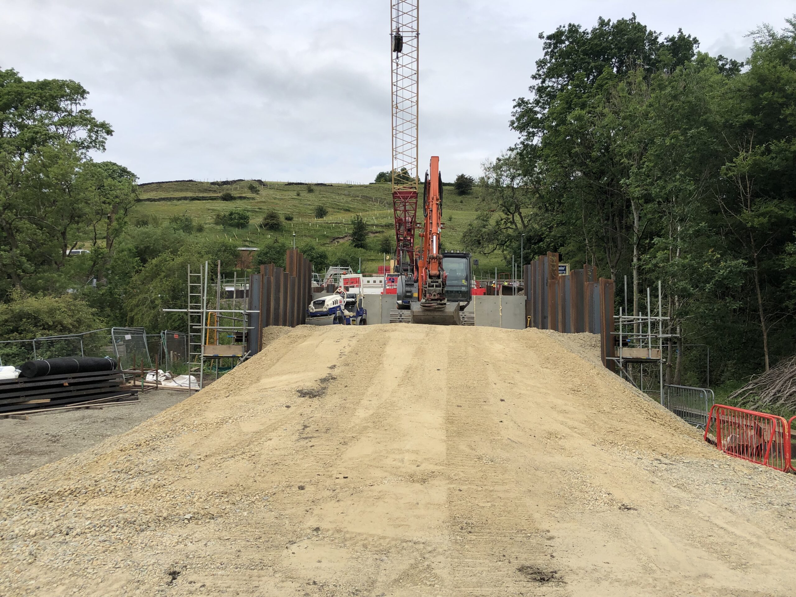
Ongoing Piling works associated with access ramp construction, 6th May 2021.
Ongoing Piling works associated with access ramp construction, 13th May 2021.
Work has been ongoing at the Gale West construction site and is making excellent progress. So far, the weather has been on The Environment Agency’s side with the sun shining on Littleborough for the majority of April. This has meant all works so far are progressing as per the programme. April saw the start of works at the Gale West site off Todmorden Road, with Traffic Management installed, initial piling works and the delivery of the huge 130 tonne crawler crane (full list of activities completed up until the end of April 2021 shown below). Unfortunately the works at this stage of the Flood Risk Management Scheme are disruptive and The Environment Agency pass on their thanks to the Littleborough community for their ongoing support and patience as they construct the vital access ramp into the Gale site. These updates will continue to be posted every other week so check back here to track The Environment Agency’s progress.
Below is a list of the works completed up to the end of April 2021:
Site prepared for next stage of construction.

22nd April – crane constructed.
Installation of Box Piles ongoing.
Installation of Box Piles ongoing.
West Abutment Piling Gate Installed Monday 26th April 2021.
Enabling work on a £56m flood alleviation scheme in Rochdale and Littleborough will get underway in the coming weeks.
It features a range of measures to reduce the risk of flooding to 1,000 residential properties and 200 local businesses across Rochdale and Littleborough.
For more information, view our news article here.

Artist impression of the access ramp which forms the main element of construction for these enabling works.
The first phase of works involves tree and vegetation clearance at one of the Littleborough sites. The integrated EA, Jacobs and Volker Stevin project team working in close partnership with Mersey Forest and Rochdale Borough Council have used the wood arising from the tree clearance works for Natural Flood Management works in the Littleborough area. The Natural Flood Management works assist in upland land management to “slow the flow” of watercourses to support flood attenuation and flood risk arising from fluvial flooding.
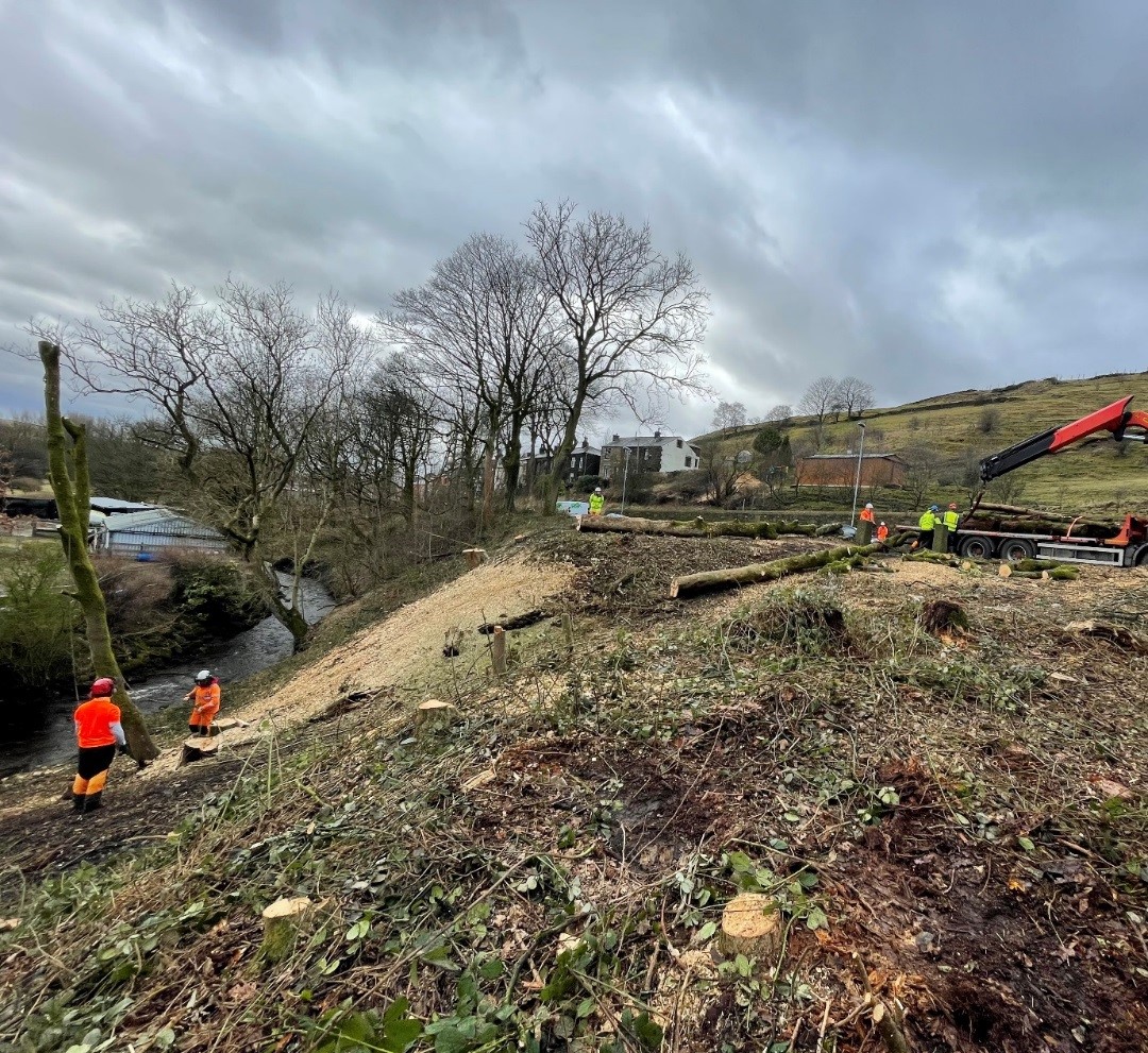
Cleared area of trees – retained wood visible for NFM use
Trees cleared from Littleborough site being utilised for Natural Flood Management works
Tree chippings from the felled trees have gone to Hollingworth Lake Park to be used to make a footpath with help of local volunteers. Trunks that were collected from the construction activity have gone from Lydgate in Oldham for use in a tree nursery and Smithills in Bolton have used log barriers and tree planting to help store water in upstream areas, to prevent flood risk. Using the trees as Natural Flood Management will protect the local community’s from flooding impacts but also bring positive benefits for wildlife, water quality and climate regulation.
Felled trees being used as log barriers at Smithills in Bolton
Here are some visualisations for the proposed flood storage basin at the Gale site in Littleborough. The documents are designed so you can zoom in and have a look at the proposals in more detail. If you have any questions or are struggling to view the documents, please contact the project team on rochdaleandlittleborough.fas@environment-agency.gov.uk
The Environment Agency will continue to use Littleborough and Wardleworth Flood Action Groups to share information with residents as well as producing more newsletters and holding public drop-in sessions (subject to Covid-19 restrictions) linked to key stages of the project.
If you are outside the flood area and would like to be kept up to date with the Rochdale and Littleborough Flood Risk Management Scheme via email, please email RochdaleAndLittleborough.FAS@environment-agency.gov.uk to be added to the mailing list.
Visit Rochdale Borough Council’s website for flood risk information: www.rochdale.gov.uk/flooding.
You can also follow the Environment Agency on Twitter: @EnvAgencyNW.
Alison Carlton – Customer experience co-ordinator at Volkerstevin
She is the point of contact for residents to discuss the Rochdale and Littleborough project or raise any questions. She will also be present at the customer drop in cabins, as well as out within the community.
Email: Alison.Carlton@volkerstevin.co.uk
Phone: 07392102093

Photo of Alison Carlton, customer experience co-ordinator.


