
Exeter, New Hampshire
Exeter, New Hampshire | |
|---|---|
 Water Street in downtown Exeter | |
 Seal | |
 Location in Rockingham County and the state of New Hampshire | |
| Coordinates: 42°58′53″N 70°56′52″W / 42.98139°N 70.94778°W | |
| Country | United States |
| State | New Hampshire |
| County | Rockingham |
| Settled | April 3, 1638 |
| Incorporated | 1638 |
| Government | |
| • Select Board | Niko Papakonstantis, Chair Molly Cowan Nancy Belanger Julie D. Gilman Daniel Chartrand |
| • Town Manager | Russell Dean |
| Area | |
| • Total | 20.0 sq mi (51.7 km2) |
| • Land | 19.6 sq mi (50.8 km2) |
| • Water | 0.3 sq mi (0.9 km2) 1.80% |
| Elevation | 33 ft (10 m) |
| Population (2020)[2] | |
| • Total | 16,049 |
| • Density | 819/sq mi (316.1/km2) |
| Time zone | UTC-5 (Eastern) |
| • Summer (DST) | UTC-4 (Eastern) |
| ZIP code | 03833 |
| Area code | 603 |
| FIPS code | 33-25380 |
| GNIS feature ID | 0873595 |
| Website | www |
Exeter is a town in Rockingham County, New Hampshire, United States. Its population was 16,049 at the 2020 census,[2] up from 14,306 at the 2010 census. Exeter was the county seat until 1997, when county offices were moved to neighboring Brentwood. Home to Phillips Exeter Academy, a private university-preparatory school, Exeter is situated where the Exeter River becomes the tidal Squamscott River.
The urban center of town, where 10,109 people resided at the 2020 census,[3] is defined by the U.S. Census Bureau as the Exeter census-designated place.
History[edit]

For thousands of years prior to European colonization, the area was inhabited by Pennacook Abenaki villagers. The location was originally known as "M’Squamskook", meaning "Falls at the Place of the Salmon" in Abenaki language, and would later become known as "Squamscott".[4]
About 100 Pennacook would return to the Squamscott in the spring to fish, and raise corn, pumpkin, and pigeons, and had relations to other Pennacook at Concord, Sewall's Island, and Manchester.[4] They fished at the falls where the Exeter River becomes the tidal Squamscott, the site around which the future town of Exeter grew. The falls in Brentwood were known to have been a favorite fishing site of the native population.[5]
1638 settlement[edit]
On April 3, 1638, John Wheelwright, a clergyman exiled from the Puritan theocracy Massachusetts Bay Colony, purchased the land from Wehanownowit, the sagamore. Wheelwright took with him about 175 individuals to found a town he named after Exeter[6] in Devon, England. Local government was linked with Massachusetts until New Hampshire became a separate colony in 1679, and counties were introduced in 1769.
One of the four original townships in the province, Exeter originally included Newmarket, Newfields, Brentwood, Epping, and Fremont. On July 4, 1639, 35 freemen of Exeter signed the Exeter Combination, a document written by Wheelwright to establish their own government.[7] The settlers hunted, planted and fished, raised cattle and swine, or made shakes (shingles) and barrel staves.
Thomas Wilson established the town's first grist mill on the eastern side of the island[clarification needed] in the lower falls. This mill was established within the first season of settling in Exeter, and his son Humphrey assumed control of the mill in 1643, when Thomas died.[8]
Gilman family[edit]
Some early settlers came from Hingham, Massachusetts, including the Gilman, Folsom, and Leavitt families.[9][10] In 1647, Edward Gilman Jr. established the first sawmill, and by 1651, Gilman had a 50-ton sloop which he used to conduct business in lumber, staves, and masts. Gilman was lost at sea in 1653 while traveling to England to purchase equipment for his mills,[11] but his family later became prominent as lumbermen, shipbuilders, merchants, and statesmen.[12][13] The Gilman Garrison House and the American Independence Museum were both former homes of the Gilman family.[14][15] The Gilman family also donated the land on which Phillips Exeter Academy stands, including the academy's original Yard, the oldest part of campus.[16] Members of the Gilman family have played an important role in the United States government, including Founding Father Nicholas Gilman, as well as treasurers, a governor, representatives to the General Assembly and judges to the General Court of New Hampshire.[17][18]

The Gilman family began trading as far as the West Indies with ships they owned out of Portsmouth. In an 1803 voyage, the 180-ton clipper Oliver Peabody, owned by Gov. John Taylor Gilman, Oliver Peabody, Col. Gilman Leavitt, and others, was boarded by brigs belonging to the Royal Navy under command of Admiral Horatio Nelson. Enforcing a blockade against the French, Nelson offered ship Captain Stephen Gilman of Exeter a glass of wine and paid him for his cargo in Spanish dollars.[19] The trip demonstrates how far afield the merchants of Exeter reached.
1700s[edit]
The last Indian raid on Exeter was in August 1723, and by 1725, the tribes had left the area.[citation needed] In 1774, the rebellious Provincial Congress began to meet in the Exeter Town House after colonial governor John Wentworth banned it from the colonial capitol at Portsmouth. In July 1775, the Provincial Congress had the provincial records seized from royal officials in Portsmouth and brought to Exeter, as well, so Exeter became New Hampshire's capital, an honor it held for 14 years.[20]

Exeter had a significant Black community at this time. In 1790, at the first census, Exeter had a community of 81 free Blacks (in 14 households, 11 of which they owned), and two enslaved Blacks.[21] This was the highest percentage of Blacks in the state at 4.7%. Many Blacks, such as Jude Hall (namesake of Jude's Pond on Drinkwater Road),[22] earned their freedom fighting in the Revolutionary War, and many settled near the west bank of the Squamscott River after the war.[23] Jude Hall is buried in the Winter Street cemetery.
1800s[edit]
Reverend Thomas Paul of the African Meeting House in Boston was born in Exeter near this time, and later in 1822, abolitionist poet James Monroe Whitfield, a nephew of Jude Hall. In the late 1800s, two men had two dry-goods stores on Water Street, John Garrison Cutler and George Harris, who both had very high net worths at the time.[citation needed]
In 1827, the Exeter Manufacturing Company was established beside the river, using water power to produce cotton textiles. Other businesses manufactured shoes, saddles, harnesses, lumber, boxes, bricks, carriages, and bicycles. In 1836, the last schooner was launched at Exeter. In 1840, the Boston & Maine Railroad entered the town.[24]
According to former governor Hugh Gregg, the United States Republican Party was born in Exeter on October 12, 1853, at the Squamscott Hotel at a secret meeting of Amos Tuck with other abolitionists. At this meeting, Tuck proposed forming a new political party to be called Republican. Upon learning of Tuck's meeting, in December 1853, Horace Greeley said, "I think 'Republican' would be the best name, it will sound both Jeffersonian and Madisonian, and for that reason will take well."[25] Abraham Lincoln, the first Republican president, visited Exeter in 1860. His son, Robert Todd Lincoln, was attending Phillips Exeter Academy, the college preparatory school founded in 1781 by John Phillips. The town was also once home to the Robinson Female Seminary, established in 1867 and previously known as the Exeter Female Academy (established in 1826). Its landmark Second Empire schoolhouse, completed in 1869, burned in October 1961.[26]
1900s[edit]
Joanna Pellerin, president of the Rockingham Land Trust, described the Squamscott River of the 1940s:
[The] Squamscott was a place to stay away from. It stank, and was filled with dyes from the mills and sewage dumped from along Water Street.[5]
In 1922, it was affected by the 1922 New England Textile Strike, shutting down the mills in the town over an attempted wage cut and hours increase.[27][28]
In September 1965, Exeter was involved in UFO history when local teenager Norman Muscarello and two Exeter police officers, Eugene Bertrand and David Hunt, witnessed a bright red UFO at close range. Their sighting attracted national publicity and became the focus of a bestselling book, Incident at Exeter, by journalist John G. Fuller. The Air Force eventually admitted that it had been unable to identify the strange object, and it is still considered by many UFO buffs to be one of the most impressive UFO sightings on record.
Architecture[edit]

Exeter has a considerable number of architectural structures. Arthur Gilman designed the Old Town Hall of 1855. The Old Public Library of 1894, which now is home to the Exeter Historical Society, was designed by the Boston firm of Rotch & Tilden. Ralph Adams Cram, who trained with Rotch & Tilden, designed both Phillips Church, built in 1897, and Tuck High School, built in 1911. Cram's firm of Cram & Ferguson designed the entire Phillips Exeter Academy campus between 1908 and 1950. More recent is the Academy Library, built in 1971 to the design of Louis I. Kahn. Sculptor Daniel Chester French created the town's war memorial in 1922. Architect Henry Bacon designed in 1916 the Swasey Pavilion at Exeter's town square.[citation needed]
Other features of the town include the Swasey Parkway, which replaced the wharves and warehouses along the Squamscott River, and the Ioka Theatre of 1915 on Water Street. The latter was built by Edward Mayer, an Exeter judge and resident. Mayer's opening feature was The Birth of a Nation, by D. W. Griffith. The theatre's curious name was proposed in a contest by a young woman with an enthusiasm for Scouting. Ioka was a Native American word meaning "playground".[citation needed]
-
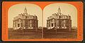
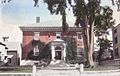 Town Offices c. 1912
 -
 Squamscott Falls in 1907
 -
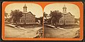
 Phillips Exeter in 1910
 -
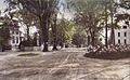 Linden Street c. 1909
 -
 Exeter Town Hall, September 2008
 -
 Powder House, 1936
 -
 Giddings Tavern, 1935
 -
 Liberty Emery House, 1935
 -
 Simeon Folsom House, 1935
 -
 First Congregational Church, c. 1870
 -
 Lower falls in winter, c. 1870
 -
 Town Hall, c. 1870
 -
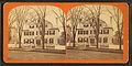 Bellows House, Front Street, c. 1870
 -
 Robinson Female Seminary, now defunct, c. 1870
 -
 Front Street, c. 1870
 -
 Phillips Exeter Academy, c. 1870


Geography and wildlife[edit]
According to the United States Census Bureau, the town has an area of 20.0 square miles (51.7 km2), of which 19.6 square miles (50.8 km2) are land and 0.3 square miles (0.9 km2) is covered by water, comprising 1.80% of the town.[1] Exeter is drained by the Exeter River, which feeds the tidal Squamscott River in the center of town. Exeter's highest point is 250 feet (76 m) above sea level, on Great Hill at the town's southwestern corner. Exeter lies fully within the Piscataqua River (Coastal) watershed.[29]
Rivers[edit]
In 2005, the small herring-like alewife fish was present in the Exeter River, though its numbers were fewer than in previous years. Local accounts suggest that the average length of the alewife was six inches. At this point in time the Exeter River was dammed in downtown Exeter, and a fish ladder would occasionally have a visible chad, lamprey eel, or trout.[5]
Water from the small freshwater Dearborn Brook is stored in the Exeter Reservoir to support municipal drinking water system. A 2005 plan to manage Dearborn Brook was submitted by the Rockingham Planning Commission through the Clean Water Act.[30] Dearborn Brook is a freshwater tributary to the tidal Squamscott River.[31]
In fall 2015, the majority of the rivers in Exeter were impaired from stormwater and snowmelt-driven runoff pollutants, including large portions of Exeter River and Squamscott River, Dudley Brook, Little River, and Piscassic River.[32]
In 2016, the Great Dam that had separated the Exeter River and the Squamscott River was removed. The removal of the dam and the fish ladder caused the alewife population to rebound, with over 100,000 fish as compared to 1,628 in 1970 and 15,626 in 1981. Hawks and eagles have been observed hunting the fish.[33]
Trees[edit]
A 2017 town survey found that most human-planted trees in the urban areas of Exeter are broadleaf deciduous. Some significant species include Norway maples, red maple, oak, sugar maples, hedge maples, and ash.[34]
Exeter also maintains a list of approved trees for planting, which include 30 trees native to the area, four trees native to the Eastern U.S., and 27 non-native species. Native trees include: Red maple, Sugar maple, Freeman maple, Serviceberry or juneberry, River birch, American hornbeam, Hackberry, Common hackberry, Pagoda dogwood, Flowering dogwood, Hawthorn, American beech, Eastern red cedar, Black gum, Ironwood, White spruce (Picea alba), Pitch pine, White pine, American sycamore, Pin cherry, White oak, Swamp white oak, Scarlet oak, Bur oak, Red oak, Black willow, Sassafras, American mountain ash (Sorbus americana 'dwarfcrown'), American linden, and American elm.[34]
Wildlife[edit]
Exeter contains the publicly-owned 235 acre Conner Farm Wildlife Management Area. This area contains about 90 acres of open fields, as well as upland forests of red oak, white oak, hemlock, and white pine. There are also black cherry, hickory, hop hornbeam, aspen, and birch trees. Additionally, there is a small freshwater marsh, a stream, and beaver ponds. Animals include deer, turkey, and migratory waterfowl.[35]
Adjacent municipalities[edit]
- Newfields (north)
- Stratham (east)
- Hampton (southeast)
- Hampton Falls (southeast)
- Kensington (south)
- East Kingston (southwest)
- Kingston (southwest)
- Brentwood (west)
- Epping (northwest)
Demographics[edit]
| Census | Pop. | Note | %± |
|---|---|---|---|
| 1790 | 1,722 | — | |
| 1800 | 1,727 | 0.3% | |
| 1810 | 1,759 | 1.9% | |
| 1820 | 2,114 | 20.2% | |
| 1830 | 2,759 | 30.5% | |
| 1840 | 2,925 | 6.0% | |
| 1850 | 3,329 | 13.8% | |
| 1860 | 3,309 | −0.6% | |
| 1870 | 3,347 | 1.1% | |
| 1880 | 3,569 | 6.6% | |
| 1890 | 4,284 | 20.0% | |
| 1900 | 4,922 | 14.9% | |
| 1910 | 4,897 | −0.5% | |
| 1920 | 4,604 | −6.0% | |
| 1930 | 4,872 | 5.8% | |
| 1940 | 5,398 | 10.8% | |
| 1950 | 5,664 | 4.9% | |
| 1960 | 7,243 | 27.9% | |
| 1970 | 8,892 | 22.8% | |
| 1980 | 11,024 | 24.0% | |
| 1990 | 12,481 | 13.2% | |
| 2000 | 14,058 | 12.6% | |
| 2010 | 14,306 | 1.8% | |
| 2020 | 16,049 | 12.2% | |
| U.S. Decennial Census[2][36] | |||
.jpg)
As of the 2010 census, there were 14,306 people, 6,114 households, and 3,729 families residing in the town. The population density was 729.9 inhabitants per square mile (281.8/km2). The 6,496 housing units had an average density of 331.4 per square mile (128.0/km2). The racial makeup of the town was 95.5% White, 0.6% African American, 0.1% Native American, 2.0% Asian, 0.2% some other race, and 1.6% from two or more races. Hispanics or Latinos of any race were 1.77% of the population.[37]
Of the 6,114 households, 29.1% had children under 18 living with them, 47.5% were headed by married couples living together, 9.8% had a female householder with no husband present, and 39.0% were not families. 32.5% of all households were made up of individuals, and 15.2% were someone living alone who was 65 or older. The average household size was 2.28, and the average family size was 2.92.[37]
In the town, the age distribution of the population was 22.6% under 18, 6.0% from 18 to 24, 22.5% from 25 to 44, 30.8% from 45 to 64, and 18.2% who were 65 or older. The median age was 44.3 years. For every 100 females, there were 88.6 males. For every 100 females 18 and over, there were 84.9 males.[37]
For the period 2007–2011, the estimated median annual income for a household in the town was $68,777, and for a family was $95,435. Male full-time workers had a median income of $64,632 versus $41,088 for females. The per capita income for the town was $38,018. About 2.5% of families and 5.7% of the population were below the poverty line, including 7.2% of those under 18 and 4.1% of those 65 or over.[38]
Government and politics[edit]
Exeter is located in New Hampshire's 1st congressional district, represented by Democrat Chris Pappas (D-Manchester). In the New Hampshire Senate, Exeter is located within New Hampshire's 24th State Senate district, represented by Democrat Debra Altschiller (D-Stratham).[39]
In the New Hampshire House of Representatives, Exeter has two districts covering the town. Rockingham 11 is a district with four seats covering just the town of Exeter; it is currently represented by four Democrats: Julie D. Gilman, Gaby M. Grossman, Linda J. Haskins, and Mark Paige. Exeter also shares Rockingham 33, a single-member district, with the several other nearby towns; it is represented by Democrat Alexis H. Simpson (D-Exeter).[40]
| Year | Democratic | Republican | Third parties |
|---|---|---|---|
| 2020 | 66.3% 6,820 | 32.3% 3,321 | 1.4% 148 |
| 2016 | 59.6% 5,514 | 35.5% 3,286 | 4.9% 445 |
| 2012 | 58.2% 5,194 | 40.5% 3,614 | 0.8% 75 |
| 2008 | 60.5% 5,258 | 38.7% 3,365 | 0.8% 71 |
Like much of eastern Rockingham County, Exeter is strongly Democratic.[41]
Transportation[edit]
The Amtrak Downeaster stops at Exeter, providing passenger rail service to Portland and Boston.
Exeter is served by four exits (9–12) from Route 101, and Interstate 95 is about 5 miles (8 km) to the east. Routes 27, 85, 108, 111, and 111A meet at the town's center, and Route 88 is on the east side of the town.
Economy[edit]
In 1990, the SIGARMS, Inc. company moved to Exeter. When it was bought by Michael Lüke and Thomas Ortmeier in October 2000, the name was changed to SIG Sauer Inc. Today, SIG Sauer is one of the world's largest firearms manufacturing entities.[42]
Bauer Hockey's global headquarters is in Exeter.[43]
Notable people[edit]
Sites of interest[edit]
- American Independence Museum
- Congregational Church in Exeter, founded 1638
- Exeter Historical Society and Museum
- Phillips Exeter Academy
See also[edit]
References[edit]
- ^ a b "2021 U.S. Gazetteer Files – New Hampshire". United States Census Bureau. Retrieved December 22, 2021.
- ^ a b c "Exeter town, Rockingham County, New Hampshire: 2020 DEC Redistricting Data (PL 94-171)". U.S. Census Bureau. Retrieved December 22, 2021.
- ^ United States Census Bureau, [1], 2020 Census figures. Retrieved September 21, 2021.
- ^ a b Collective, Indigenous NH Collaborative (November 19, 2021). "The Obscure History of Indigenous Exeter". Indigenous New Hampshire Collaborative Collective. Retrieved June 7, 2023.
- ^ a b c Exeter River Local Advisory Committee (June 21, 2005). "2005 Exeter River Alewife Festival". PREP Reports & Publications.
- ^ Gannett, Henry (1905). The Origin of Certain Place Names in the United States. Govt. Print. Off. pp. 122.
- ^ Fitts, James Hill (1912). History of Newfields, New Hampshire, 1638-1911. Concord, NH: The Rumford Press. p. 22. Retrieved October 22, 2010.
- ^ Bell, Charles H. (1888). History of the Town of Exeter, New Hampshire. Boston, MA: J. E. Farwell. pp. 317–318. Retrieved October 22, 2010.
- ^ Lincoln, Solomon (1827). History of the Town of Hingham, Plymouth County, Massachusetts. Hingham, MA: Farmer and Brown. pp. 174–175.
- ^ John Leavitt, founding deacon of Old Ship Church in Hingham, was granted land in Exeter in 1652, but there is no sign that he took up residence. But his sons Moses and Samuel Leavitt moved to Exeter, presumably to be closer to their maternal grandfather, Edward Gilman Sr."WALF Memoriam to the Children of John Leavitt and Sarah Gilman, Hingham Cemetery, Hingham, Massachusetts". Flickr. October 8, 2008. Retrieved October 22, 2010.
- ^ Savage, James; John Farmer; Orrando Perry Dexter (1860). A Genealogical Dictionary of the First Settlers of New England, Vol. II. Boston, MA: Little, Brown and Company.
- ^ Perley, Sidney (July 1905). "Suffolk County Deeds, Vol. 1". The Essex Antiquarian. IX (3). Salem, MA: 103. Retrieved October 22, 2010.
- ^ Perley, Sidney (July 1897). "Old Norfolk County Records". The Essex Antiquarian. I (7). Salem, MA: 115. Retrieved October 22, 2010.
- ^ "Gilman Garrison House". Historic New England. Archived from the original on August 16, 2014. Retrieved October 22, 2010.
- ^ "The Ladd-Gilman House". The American Independence Museum. Archived from the original on July 10, 2011. Retrieved October 22, 2010.
- ^ Gilman, Alexander (1895). Searches Into the History of the Gillman or Gilman family. London: E. Stock. p. 214. Retrieved October 22, 2010.
- ^ Merrill, Nancy. "The Gilmans of Exeter". SeacoastNH.com. Retrieved October 22, 2010.
- ^ Bell, Charles Henry. John Taylor Gilman, M. D., Portland Maine: A memorial for the family.
- ^ Brewster, Charles Warren (1869). Rambles About Portsmouth. Portsmouth, NH: Lewis W. Brewster. p. 291. Retrieved October 22, 2010.
- ^ "Exeter - Its History". American Independence Museum. Archived from the original on March 9, 2015. Retrieved March 23, 2015.
- ^ Pruitt, Sarah (June 7, 2019). "He Fought for His Freedom in the Revolution. Then His Sons Were Sold Into Slavery". History.com. Retrieved October 13, 2020.
- ^ Rimkunas, Barbara (February 28, 2014). "Jude Hall and his family's struggle". Seacoast Online. Retrieved October 13, 2020.
- ^ Dixon, David T. "Freedom Earned, Equality Denied: Evolving Race Relations in Exeter and Vicinity, 1776–1876" (PDF). Historical New Hampshire. Retrieved October 13, 2020.
- ^ "Boston and Maine Railroad: 'Route of the Minute Man'". American-Rails.com. Retrieved October 13, 2020.
- ^ "Birth of the Republican Party", H. Gregg
- ^ "Old Girls' School Burns At Exeter". The Times Argus. Barre, Vermont. AP. October 6, 1961. p. 10. Retrieved January 22, 2024 – via newspapers.com.
- ^ Foner, Philip Sheldon; Foner, Philip Sheldon (January 1, 1991). History of the labor movement in the United States. 9: The T.U.E.L. to the end of the Gompers era / by Philip S. Foner. New York: Intl Publ. pp. 19–31. ISBN 978-0-7178-0674-4.
- ^ E. Tilden, Leonard (1923). "New England Textile Strike". Monthly Labor Review. 16 (5): 13–36. JSTOR 41828627 – via JSTOR.
- ^ Foster, Debra H.; Batorfalvy, Tatianna N.; Medalie, Laura (1995). Water Use in New Hampshire: An Activities Guide for Teachers. U.S. Department of the Interior and U.S. Geological Survey.
- ^ Rockingham Planning Commission. "Implementation of the Dearborn Brook Watershed Management and Protection Plan." (2005). [2]
- ^ Exeter-Squamscott River Local Advisory Committee (December 2012). "Exeter-Squamscott River Watershed Management Plan Update" (PDF).
- ^ "Think Blue Exeter | Town of Exeter New Hampshire Official Website". www.exeternh.gov. Retrieved June 7, 2023.
- ^ "Successful removal of Exeter's Great Dam offers lessons for other communities". Foster's Daily Democrat. Retrieved June 7, 2023.
- ^ a b "Exeter Tree Committee | Town of Exeter New Hampshire Official Website". www.exeternh.gov. Retrieved June 7, 2023.
- ^ Department, NH Fish and Game. "New Hampshire Wildlife Management Areas | New Hampshire Fish and Game Department". www.wildlife.state.nh.us. Retrieved June 5, 2023.
- ^ "Census of Population and Housing". Census.gov. Retrieved June 4, 2016.
- ^ a b c "Profile of General Population and Housing Characteristics: 2010 Demographic Profile Data (DP-1): Exeter town, Rockingham County, New Hampshire". U.S. Census Bureau, American Factfinder. Archived from the original on February 12, 2020. Retrieved March 4, 2013.
- ^ "Selected Economic Characteristics: 2007-2011 American Community Survey 5-Year Estimates (DP03): Exeter town, Rockingham County, New Hampshire". U.S. Census Bureau, American Factfinder. Archived from the original on February 12, 2020. Retrieved March 4, 2013.
- ^ "Who's My New Hampshire State Senator?". The New Hampshire General Court. Retrieved September 23, 2023.
- ^ "New Hampshire House Members". The New Hampshire General Court.
- ^ a b "NH-SOS - 2020 Election Information".
- ^ "History - Sig Sauer". Archived from the original on January 13, 2010. Retrieved July 18, 2014.
- ^ "Contact Us/FAQ - BAUER". www.bauer.com.
Further reading[edit]
- Cross-Grained & Wiley Waters: A Guide to the Piscataqua Maritime Region, Jeffrey W. Bolster, Editor; Peter Randall Publisher, Portsmouth, 2001
- Exeter New Hampshire 1888–1988, Nancy C. Merrill; Peter E. Randall, Publisher, Exeter, NH 1988
- History of Exeter, New Hampshire, Charles H. Bell, Exeter, NH 1888; Reprinted by Heritage Books, 1990
- Images of America: Exeter, Carol Walker Aten; Arcadia Publishers, Dover, NH, 1996, reprint 1998
- Ports of Piscataqua: Soundings in the Maritime History of the Portsmouth, N.H., Customs District from the Days of Queen Elizabeth and the Planting of Strawberry Banke to the Times of Abraham Lincoln and the Waning of the American Clipper, William Gurdon Saltonstall, Harvard University Press, Cambridge, 1941
- Postcards from Exeter, Carol Walker Aten; Arcadia Publishers, Dover, NH, 2003
- The Exeter-Squamscott: River of Many Uses, Olive Tardiff; Peter E. Randall, Publisher, Exeter, NH 1986, 2004
External links[edit]
- Official website
- Exeter Historical Society
- SAU 16, Exeter Area School District
- Exeter Public Library Archived 2021-11-04 at the Wayback Machine
- New Hampshire Economic and Labor Market Information Bureau Profile
- Exeter LitFest: Literary Trail Walking Maps
Places adjacent to Exeter, New Hampshire | |
|---|---|
Municipalities and communities of Rockingham County, New Hampshire, United States | ||
|---|---|---|
| City |  | |
| Towns |
| |
| CDPs | ||
| Other villages | ||
| International | |
|---|---|
| National | |
| Other | |